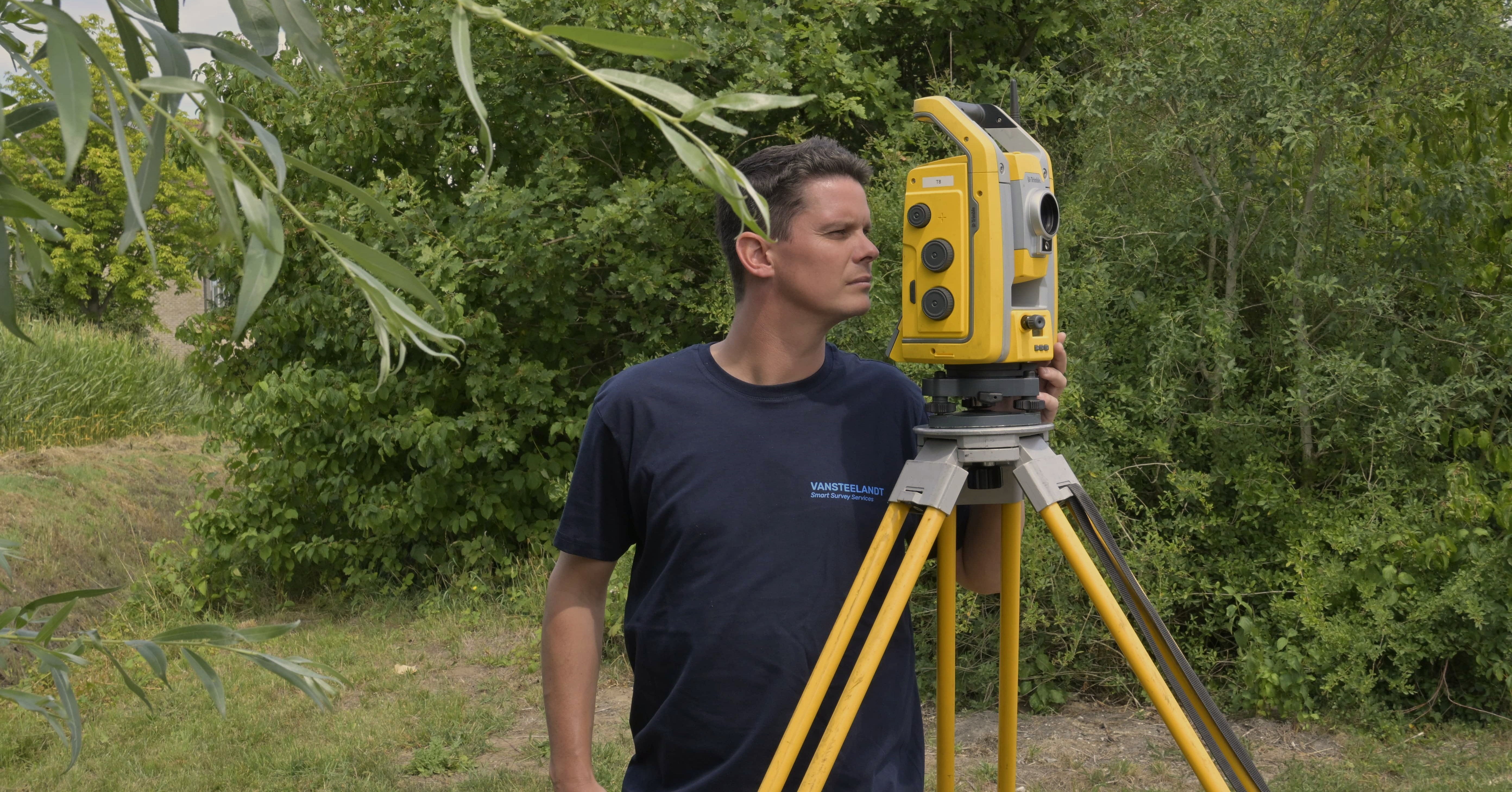
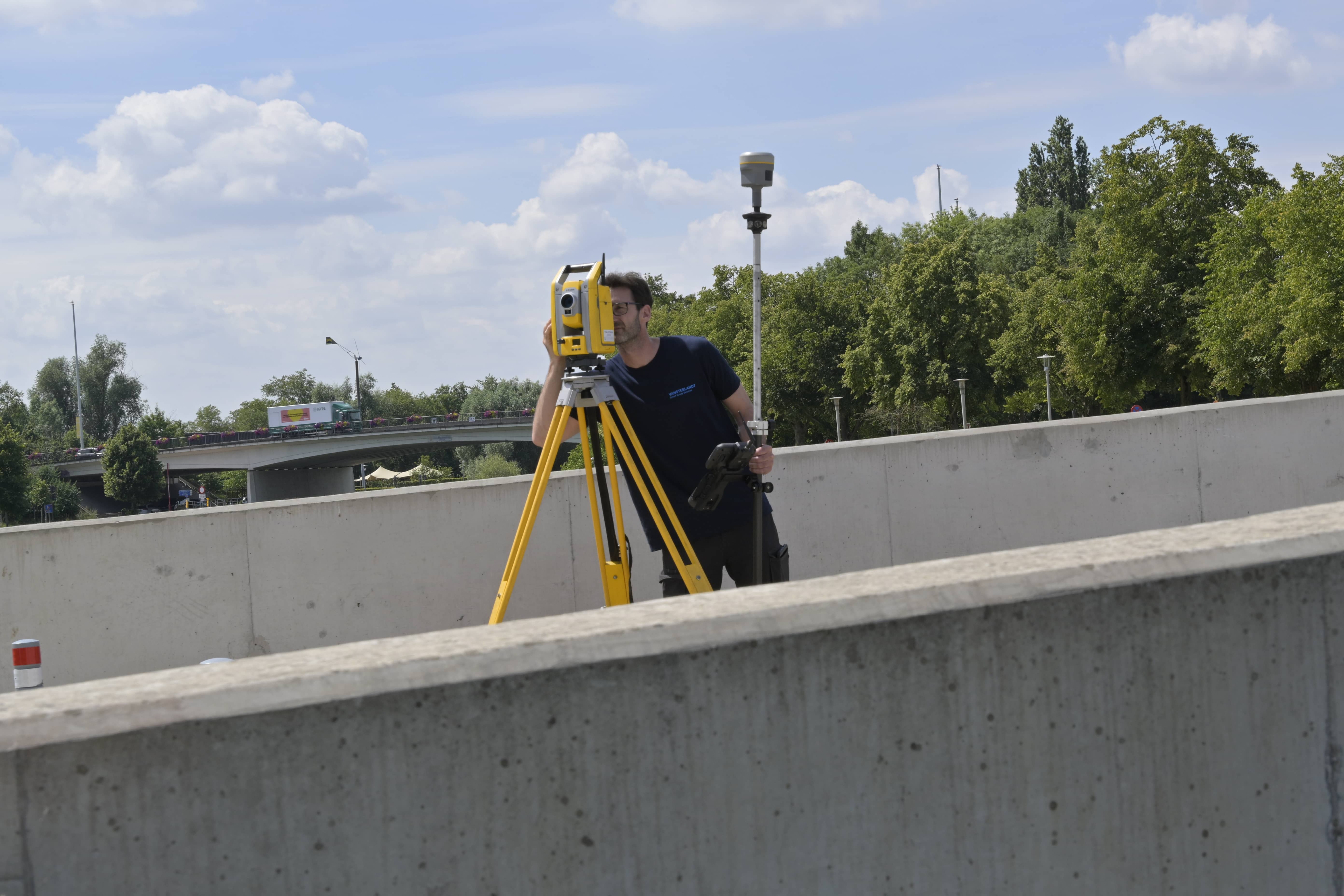
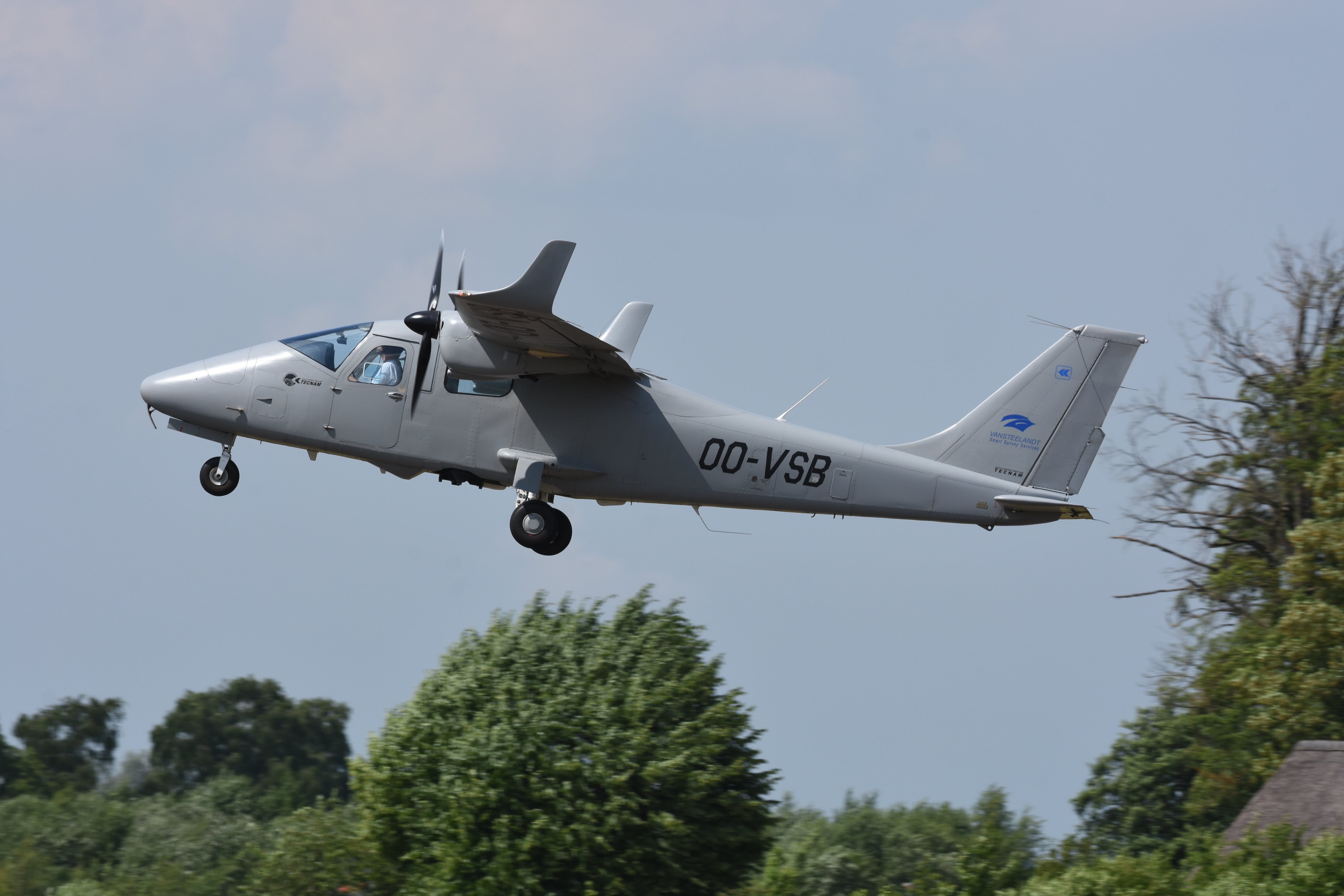
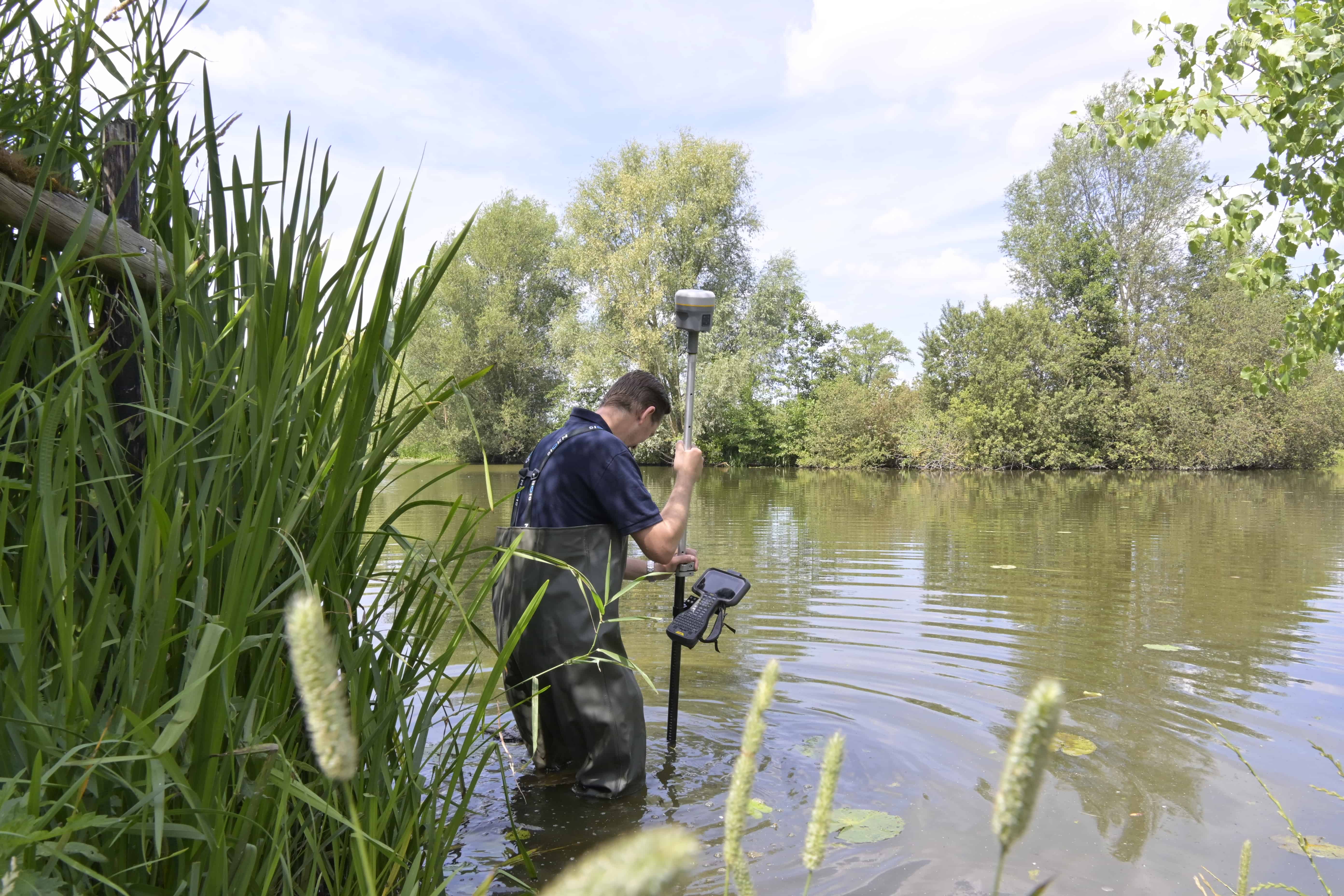
With our site surveys we accurately map the existing situation: from high-voltage pylons, streams and terrain to buildings and earthworks. Our surveyors work with GPS and total stations, ensuring every point is recorded with high precision. For larger projects we combine these surveys with our aerial data. This allows the majority of the site to be efficiently mapped from the air, after which our surveyors verify and measure the hard-to-reach or critical areas on the ground.
Our site surveys are delivered in CAD or GIS files, such as DWG, DXF, Shapefile or GML, fully tailored to your requirements. The data can be received directly via our FTP server, so you can get to work with it immediately. Everything is prepared for seamless integration into your workflow or design software, allowing you to work efficiently without any additional processing.
We guarantee that surveys are carried out on time and according to schedule, with clear progress updates. Because our surveyors work with GPS and total stations, you are assured of accurate and reliable measurement results.
.svg)
.svg)

By combining our aerial data with ground measurements, we can efficiently map large areas while accurately verifying the critical or hard-to-reach zones on site. This delivers a complete and detailed picture of the project area, without unnecessary delays or additional fieldwork.
We carry out site surveys for Digitaal Vlaanderen, performing highly detailed and accurate measurements of parcels, terrain and buildings. In doing so we actively contribute to maintaining and keeping the GRB (Large-Scale Reference Database) up to date, ensuring you always have access to current and reliable base data for GIS, spatial planning and asset management.
Our site surveys are suited to a wide range of projects and objects, from basins, waterways and tunnels to complex infrastructure and sites with hard-to-reach areas. This allows us to capture every detail of the terrain regardless of size or complexity, giving you a complete and reliable picture for design, spatial planning and asset management.

By 2040, Flanders must be asbestos-safe. Our aerial imagery and Deep Learning flag which roofs are suspected per address, so we can work together efficiently towards a healthier and safer living environment.
read more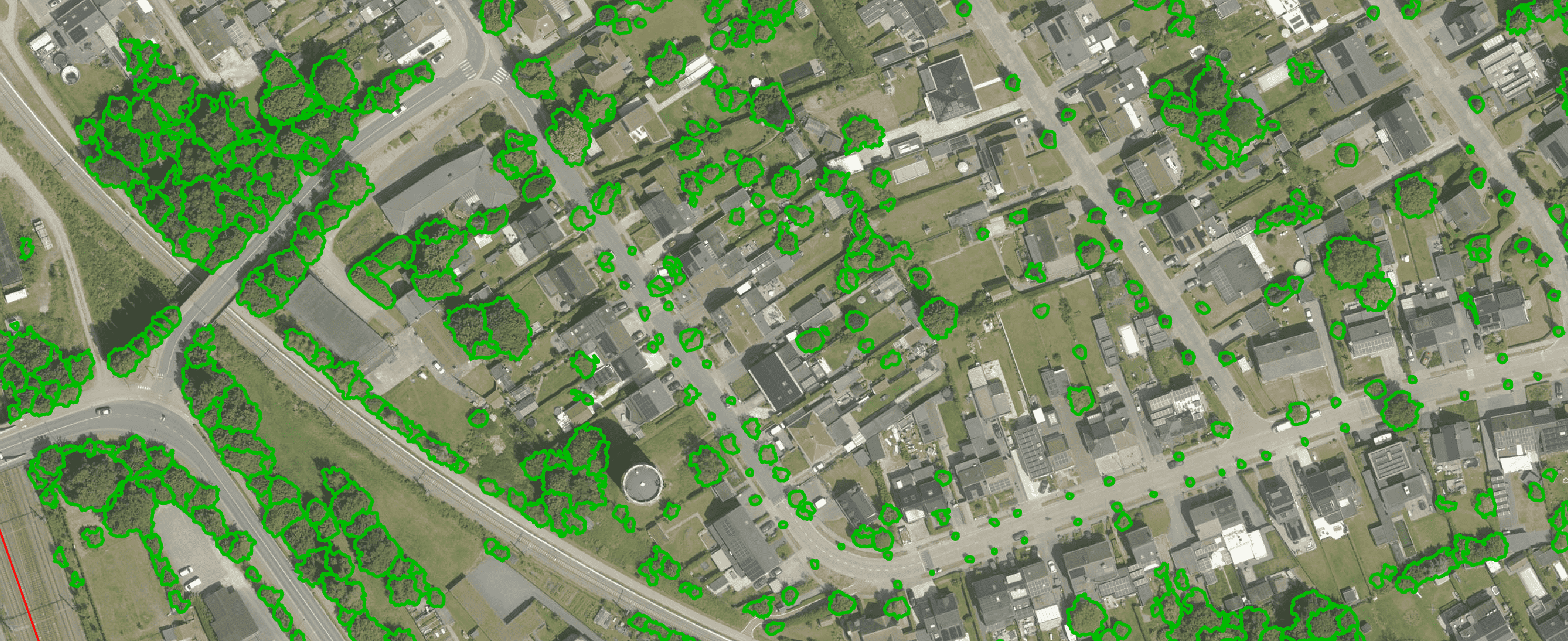
Get a complete overview of trees in your area, including individual characteristics such as crown area and height, and use the data to apply the European 3-30-300 rule for optimal urban greening. Ideal for municipalities, planners and green space managers who need accurate, scalable and policy-relevant geospatial data
read more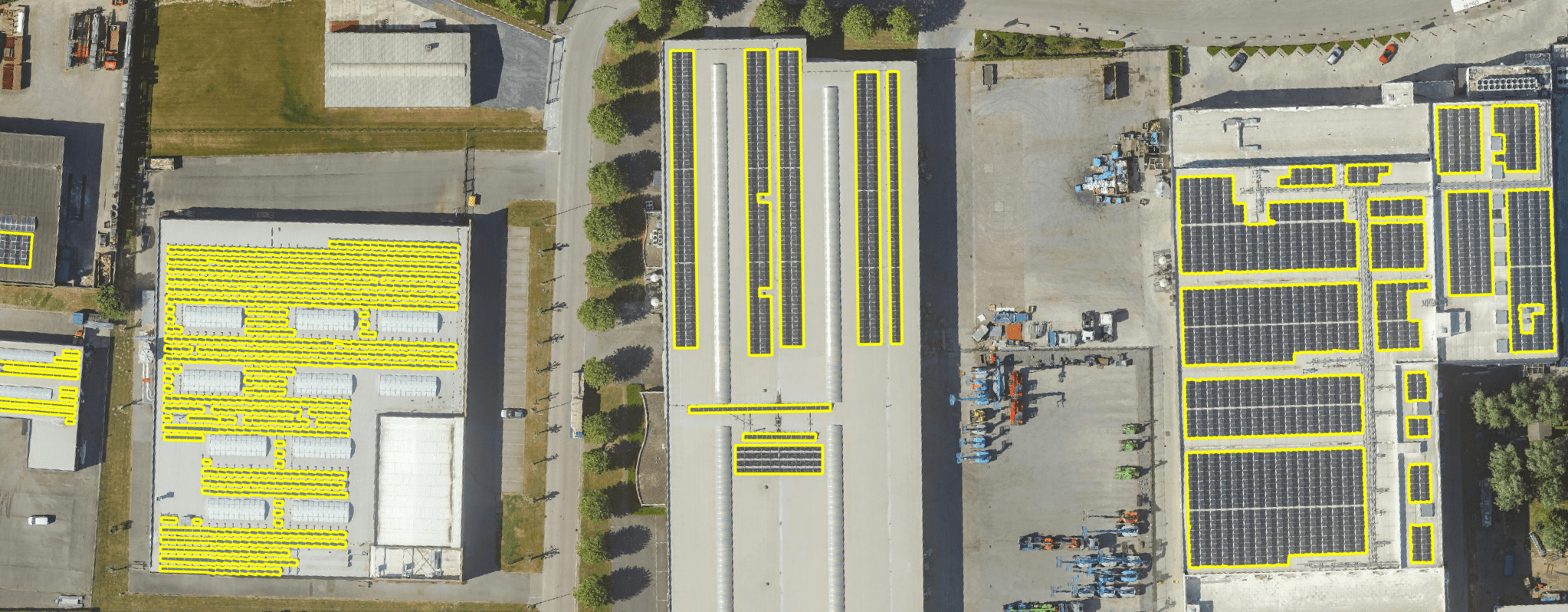
Get a detailed map layer of solar panels at building or cluster level, including surface area calculations per cluster. Ideal for anyone working with geospatial data who wants insight into energy potential and roof utilisation.
read more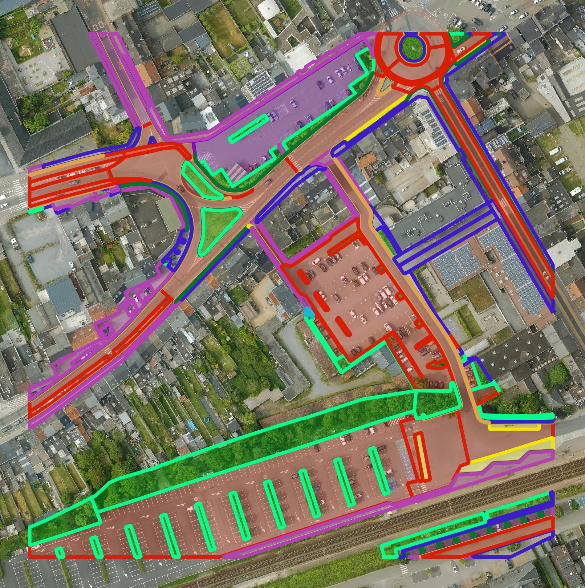
Get a detailed map layer of the public space with classification by object and material. Ideal for anyone working with geospatial data who needs more detail than existing reference data provides.
read more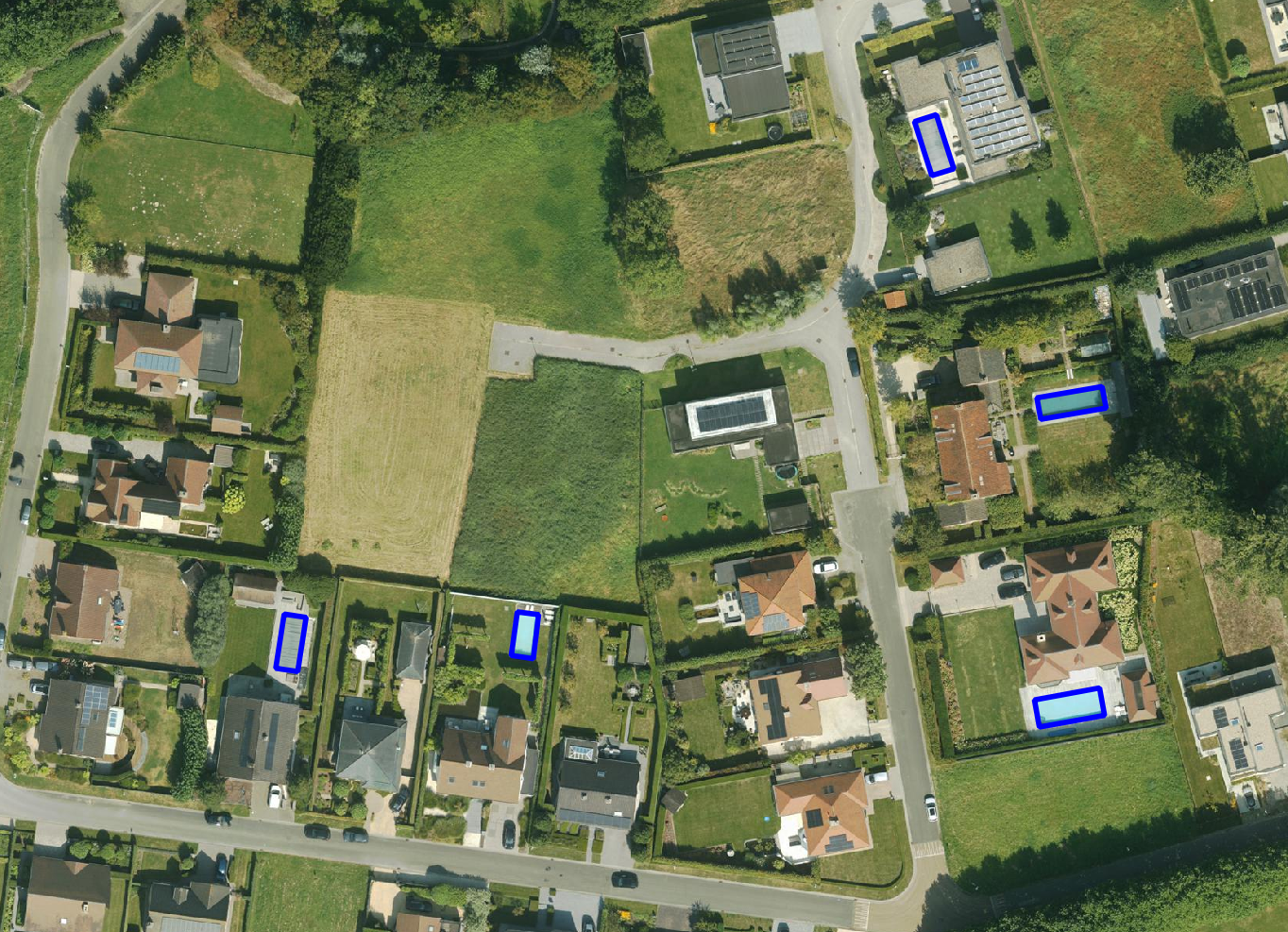
Get a detailed map layer of swimming pools at parcel or object level, including surface area calculations. Ideal for anyone using geospatial data for policy analysis, permits or trend research.
read more
Get a complete inventory of all road markings within your project area, classified into objects, lines and surfaces and linked to the correct underlying surface. This gives you objective data to support maintenance planning, reporting and policy decisions around mobility and asset management.
read more
Our paved/unpaved surface maps provide a complete and objective overview of where the ground is paved or unpaved, in both private and public space.
read moreEvery possible element of a cemetery is mapped. The result is a clear and organised plan that supports efficient and transparent cemetery management.
read more
Do you need a specific inventory that is not yet in our offering? We develop custom inventories tailored to your project. Thanks to our experience with aerial imagery and Deep Learning, we can detect and map almost any object type. Get in touch to discuss the possibilities.
Get in touchBy 2040, Flanders must be asbestos-safe. Our aerial imagery and Deep Learning flag which roofs are suspected per address, so we can work together efficiently towards a healthier and safer living environment.
read moreGet a complete overview of trees in your area, including individual characteristics such as crown area and height, and use the data to apply the European 3-30-300 rule for optimal urban greening. Ideal for municipalities, planners and green space managers who need accurate, scalable and policy-relevant geospatial data.
read moreGet a detailed map layer of solar panels at building or cluster level, including surface area calculations per cluster. Ideal for anyone working with geospatial data who wants insight into energy potential and roof utilisation.
read more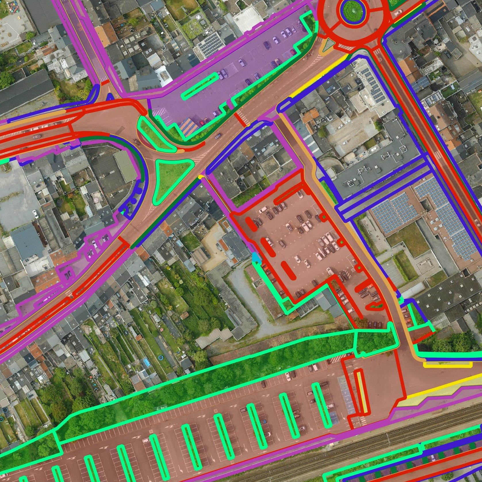
Get a detailed map layer of the public space with classification by object and material. Ideal for anyone working with geospatial data who needs more detail than existing reference data provides.
read moreGet a detailed map layer of swimming pools at parcel or object level, including surface area calculations. Ideal for anyone using geospatial data for policy analysis, permits or trend research.
read moreGet a complete inventory of all road markings within your project area, classified into objects, lines and surfaces and linked to the correct underlying surface. This gives you objective data to support maintenance planning, reporting and policy decisions around mobility and asset management.
read moreOur pavement surface maps provide a complete and objective overview of where the ground is paved or unpaved, in both private and public space.
read moreEvery possible element of a cemetery is mapped. The result is a clear and organised plan that supports efficient and transparent cemetery management.
read moreDo you need a specific inventory that is not yet in our offering? We develop custom inventories tailored to your project. Thanks to our experience with aerial imagery and Deep Learning, we can detect and map almost any object type. Get in touch to discuss the possibilities.
Get in touch
Survey of high-voltage pylons, tunnels, waterways and other critical infrastructure for maintenance, expansion or planning. The combination of aerial and ground surveys ensures complete coverage and precision, even in hard-to-reach areas, reducing risks and operational costs.

Supporting Digitaal Vlaanderen, maintaining the GRB (Large-Scale Reference Database), hydrological analyses and spatial planning. This detailed and verified terrain and object data supports policy decisions, planning and GIS applications, making public projects more efficient and reliable.

Survey of parcels, terrain and existing buildings for new construction projects or earthworks. This accurate and up-to-date survey data speeds up the design and permit process and minimises errors or surprises on site.
Survey of high-voltage pylons, tunnels, waterways and other critical infrastructure for maintenance, expansion or planning. The combination of aerial and ground surveys ensures complete coverage and precision, even in hard-to-reach areas, reducing risks and operational costs.
Supporting Digitaal Vlaanderen, maintaining the GRB (Large-Scale Reference Database), hydrological analyses and spatial planning. This detailed and verified terrain and object data supports policy decisions, planning and GIS applications, making public projects more efficient and reliable.
Survey of parcels, terrain and existing buildings for new construction projects or earthworks. This accurate and up-to-date survey data speeds up the design and permit process and minimises errors or surprises on site.

