
De inventarisatie van materialen wordt uitgevoerd op basis van onze true orthofoto's (GSD vanaf 3 cm), gecombineerd met AI-modellen die in samenwerking met KU Leuven (EAVISE) zijn ontwikkeld. Lees het volledig wetenschappelijk artikel over de samenwerking met KU Leuven.Het product wordt opgesplitst in twee hoofdcomponenten:Materialen: boordsteen, klinkers, straatgoten (klinkers, beton, kasseien), asfalt, beton, gravel, grasdallen, kasseien, onverhard en andere.Functies: fietspad, boordsteen, parkeerzone, voetpad, straatgoot, straat, spoorwegovergang en andere publieke functies.De inventaris wordt geleverd als één GeoPackage met twee aparte stijlen: één voor materialen en één voor functies. Hierdoor kun je de data eenvoudig bewerken in een GIS-platform, zoals QGIS, of direct visualiseren in de Plan3D Webviewer.De inventarisatie is indicatief en volledig objectief, en geeft een betrouwbaar overzicht van de publieke ruimte. Houd er rekening mee dat sommige zones mogelijk niet volledig zichtbaar zijn (bijvoorbeeld onder geparkeerde voertuigen of dichtbegroeide vegetatie).
The material inventory is carried out based on our True Orthophotos (GSD from 3 cm), combined with AI models developed in collaboration with KU Leuven (EAVISE).
Read the full scientific article on the collaboration with KU Leuven.
The product is split into two main components:
The inventory is delivered as a single GeoPackage with two separate styles: one for materials and one for functions. This allows you to easily edit the data in a GIS platform such as QGIS, or visualise it directly in the Plan3D Webviewer.
The inventory is indicative and fully objective, providing a reliable overview of the public space. Please note that some zones may not be fully visible (for example under parked vehicles or dense vegetation).
The inventory is delivered digitally via hard drive or FTP, in common GIS formats that you can easily integrate into your own systems. Delivery always takes place as quickly as possible, with the schedule agreed in advance based on the scope of the project so you know clearly when the data will be available.
We always deliver the inventory in the agreed formats, fully checked for quality and immediately ready to use in your workflow. Our methodology is transparent and repeatable, with automatic extractions and links to official datasets, so you can be confident that the results are reliable and consistent.


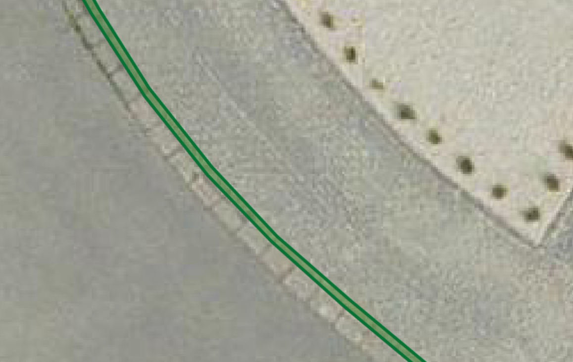
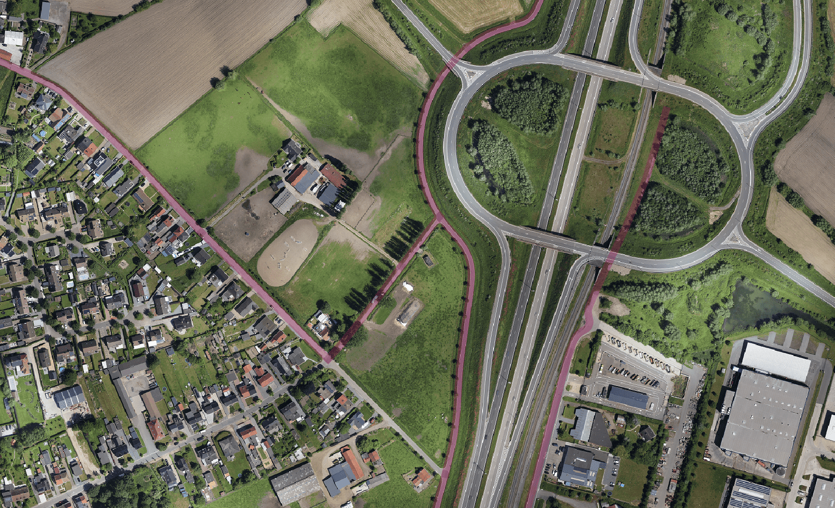
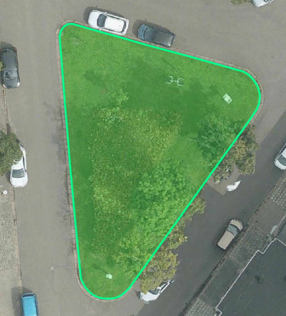
Our inventory distinguishes between different material layers such as asphalt, paving blocks or gravel, and links these to public functions such as cycle paths, parking zones or street gutters. This allows municipalities, planners and engineers to draw up targeted analyses and maintenance plans.

Our detection models were developed in collaboration with EAVISE (KU Leuven), a leading research group in visual AI. This guarantees innovative algorithms and reliable results. These Deep Learning algorithms automatically recognise different materials in the public space, such as asphalt, paving blocks, concrete or kerb stones, based on colour, texture, shape and contextual features. After the automated detection, a thorough quality control is carried out by our specialists to minimise incorrect classifications. This gives us a reliability of over 95%.
The dataset can easily be integrated into any GIS platform or linked to the Plan3D Webviewer, allowing you to directly visualise, analyse and combine the inventory with other layers such as buildings, parcels or paved surfaces.
Our inventory distinguishes between different material layers such as asphalt, paving blocks or gravel, and links these to public functions such as cycle paths, parking zones or street gutters. This allows municipalities, planners and engineers to draw up targeted analyses and maintenance plans.
Our detection models were developed in collaboration with EAVISE (KU Leuven), a leading research group in visual AI. This guarantees innovative algorithms and reliable results. These Deep Learning algorithms automatically recognise different materials in the public space, such as asphalt, paving blocks, concrete or kerb stones, based on colour, texture, shape and contextual features. After the automated detection, a thorough quality control is carried out by our specialists to minimise incorrect classifications. This gives us a reliability of over 95%.
The dataset can easily be integrated into any GIS platform or linked to the Plan3D Webviewer, allowing you to directly visualise, analyse and combine the inventory with other layers such as buildings, parcels or paved surfaces.

By 2040, Flanders must be asbestos-safe. Our aerial imagery and Deep Learning flag which roofs are suspected per address, so we can work together efficiently towards a healthier and safer living environment.
read more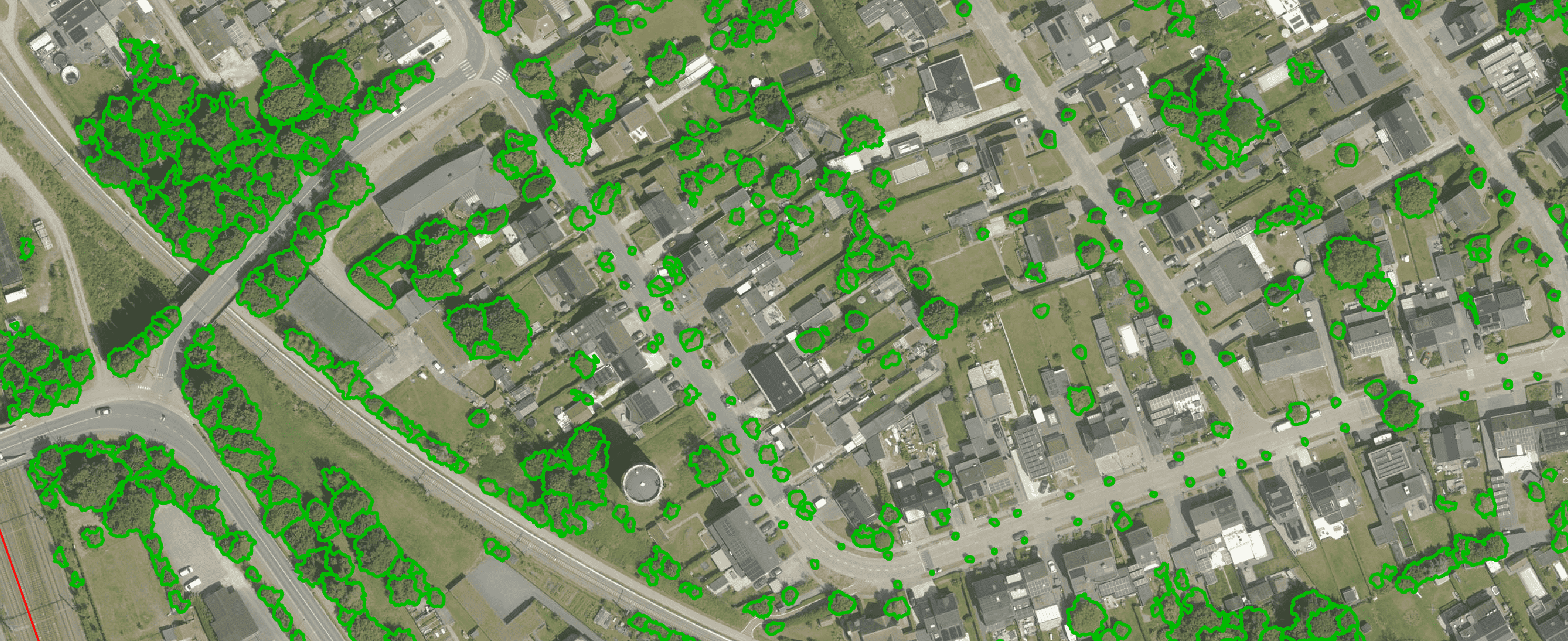
Get a complete overview of trees in your area, including individual characteristics such as crown area and height, and use the data to apply the European 3-30-300 rule for optimal urban greening. Ideal for municipalities, planners and green space managers who need accurate, scalable and policy-relevant geospatial data
read more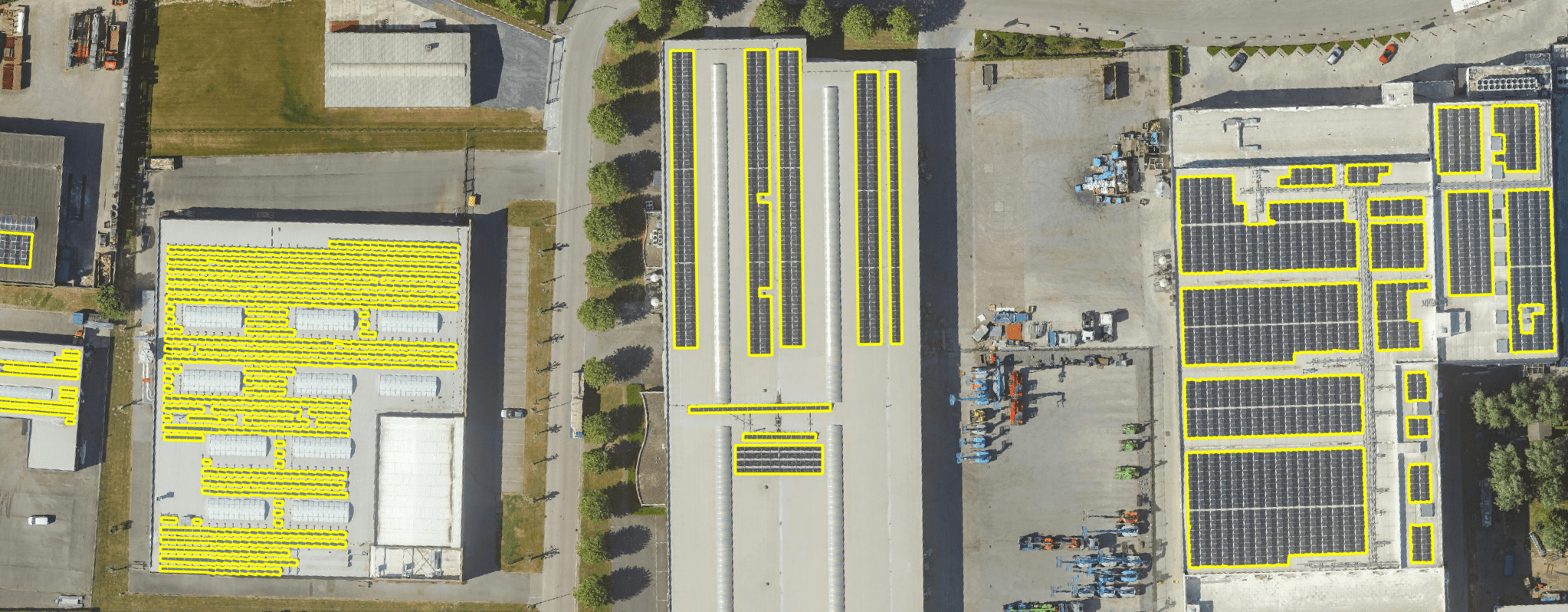
Get a detailed map layer of solar panels at building or cluster level, including surface area calculations per cluster. Ideal for anyone working with geospatial data who wants insight into energy potential and roof utilisation.
read more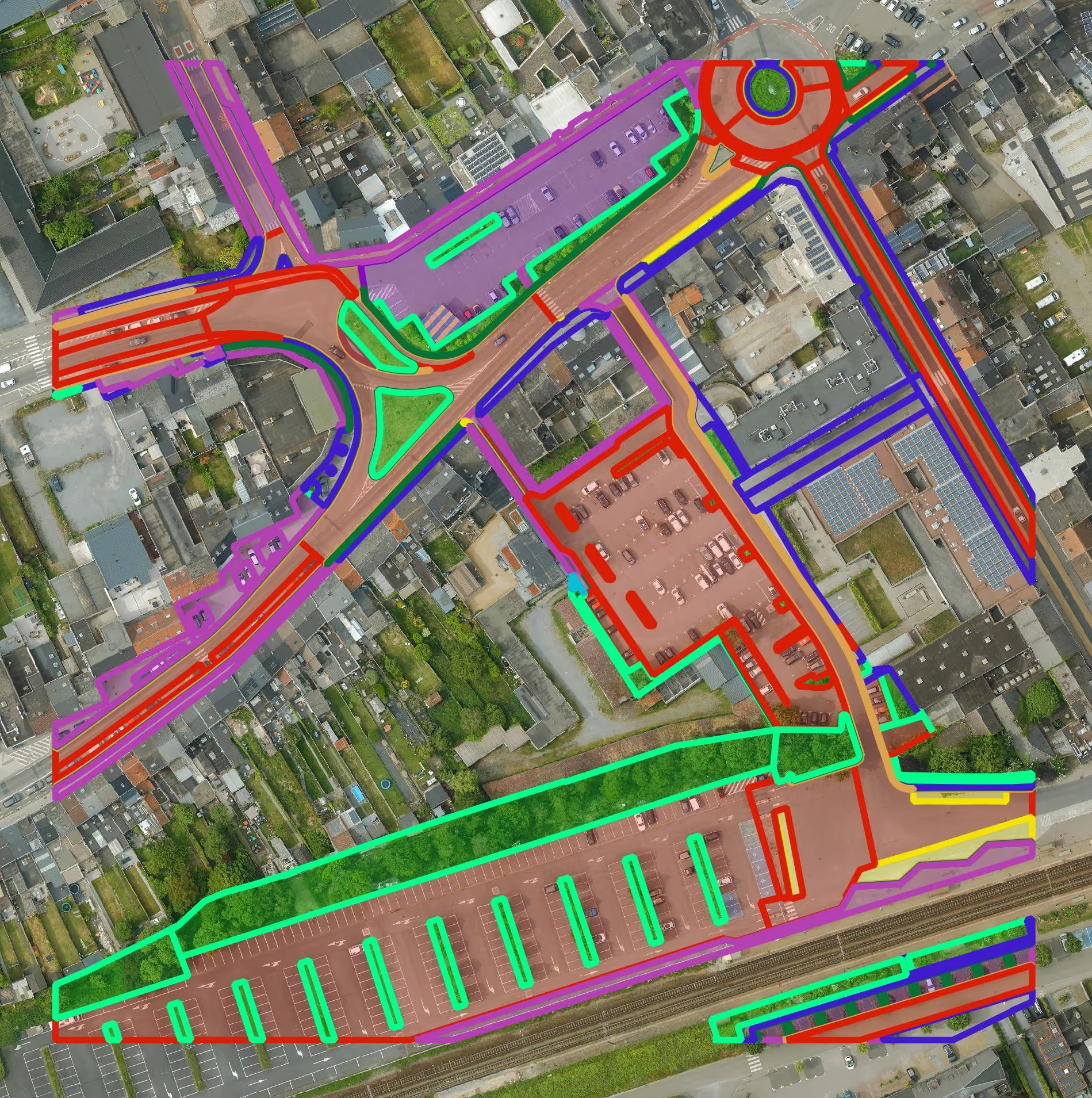
Get a detailed map layer of the public space with classification by object and material. Ideal for anyone working with geospatial data who needs more detail than existing reference data provides.
read more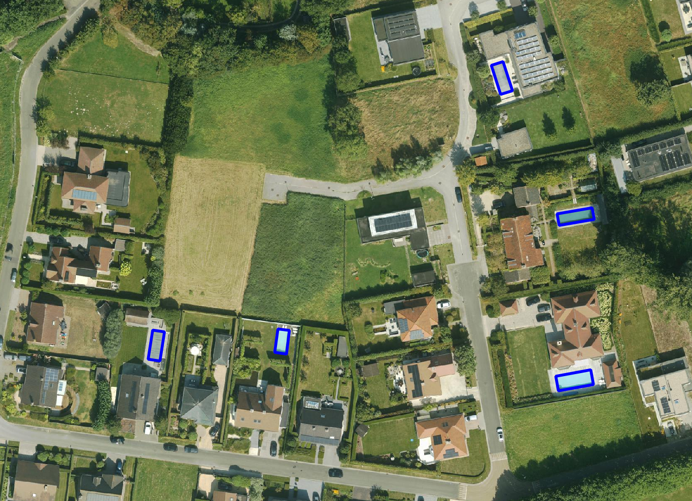
Get a detailed map layer of swimming pools at parcel or object level, including surface area calculations. Ideal for anyone using geospatial data for policy analysis, permits or trend research.
read more
Get a complete inventory of all road markings within your project area, classified into objects, lines and surfaces and linked to the correct underlying surface. This gives you objective data to support maintenance planning, reporting and policy decisions around mobility and asset management.
read more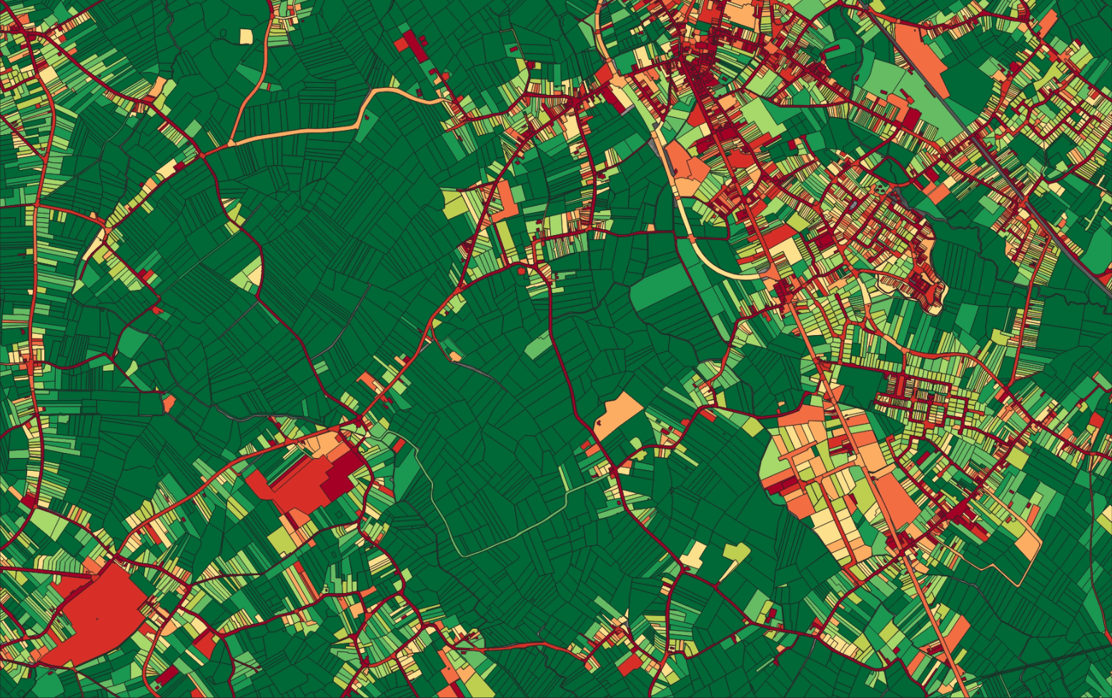
Our paved/unpaved surface maps provide a complete and objective overview of where the ground is paved or unpaved, in both private and public space.
read moreEvery possible element of a cemetery is mapped. The result is a clear and organised plan that supports efficient and transparent cemetery management.
read more
Do you need a specific inventory that is not yet in our offering? We develop custom inventories tailored to your project. Thanks to our experience with aerial imagery and Deep Learning, we can detect and map almost any object type. Get in touch to discuss the possibilities.
Get in touchBy 2040, Flanders must be asbestos-safe. Our aerial imagery and Deep Learning flag which roofs are suspected per address, so we can work together efficiently towards a healthier and safer living environment.
read moreGet a complete overview of trees in your area, including individual characteristics such as crown area and height, and use the data to apply the European 3-30-300 rule for optimal urban greening. Ideal for municipalities, planners and green space managers who need accurate, scalable and policy-relevant geospatial data.
read moreGet a detailed map layer of solar panels at building or cluster level, including surface area calculations per cluster. Ideal for anyone working with geospatial data who wants insight into energy potential and roof utilisation.
read more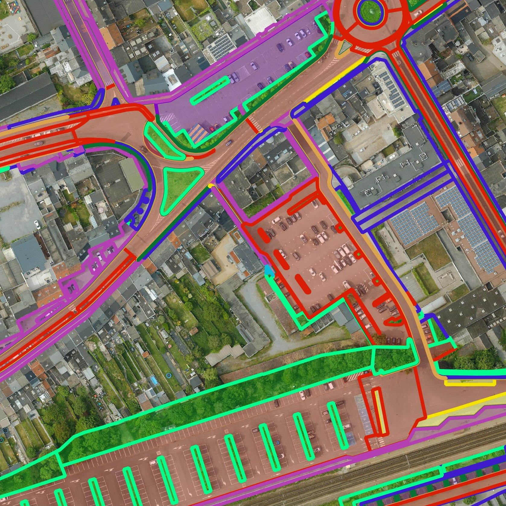
Get a detailed map layer of the public space with classification by object and material. Ideal for anyone working with geospatial data who needs more detail than existing reference data provides.
read moreGet a detailed map layer of swimming pools at parcel or object level, including surface area calculations. Ideal for anyone using geospatial data for policy analysis, permits or trend research.
read moreGet a complete inventory of all road markings within your project area, classified into objects, lines and surfaces and linked to the correct underlying surface. This gives you objective data to support maintenance planning, reporting and policy decisions around mobility and asset management.
read moreOur pavement surface maps provide a complete and objective overview of where the ground is paved or unpaved, in both private and public space.
read moreEvery possible element of a cemetery is mapped. The result is a clear and organised plan that supports efficient and transparent cemetery management.
read moreDo you need a specific inventory that is not yet in our offering? We develop custom inventories tailored to your project. Thanks to our experience with aerial imagery and Deep Learning, we can detect and map almost any object type. Get in touch to discuss the possibilities.
Get in touch
Optimise maintenance planning for roads, cycle paths and parking zones, and monitor public infrastructure.

Integrate material and function data into environmental studies, maintenance of vegetation alongside infrastructure and an overview of unpaved zones.

Improve the coordination of works and maintenance with a uniform and reliable inventory of the public space.
Optimise maintenance planning for roads, cycle paths and parking zones, and monitor public infrastructure.
Integrate material and function data into environmental studies, maintenance of vegetation alongside infrastructure and an overview of unpaved zones.
Improve the coordination of works and maintenance with a uniform and reliable inventory of the public space.

