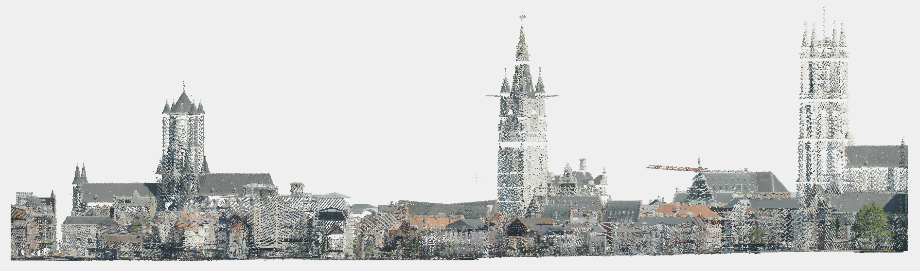
Our LiDAR captures deliver a dense point cloud with more than 30 points per m², georeferenced and available in colour or monochrome. Thanks to a cone-shaped rotation system, both rooftops and base points of buildings are fully captured. With integrated GPS/IMU, an accuracy of a few centimetres is achieved. The dataset can be flexibly tiled to your requirements and forms a powerful basis for 3D measurements, cross-sections and analyses. It can also be classified by us. Our LiDAR Point Cloud is included in a Plan3D license and can be consulted via our web viewer. The data is also available on request and can easily be supplemented with a True Orthophoto.
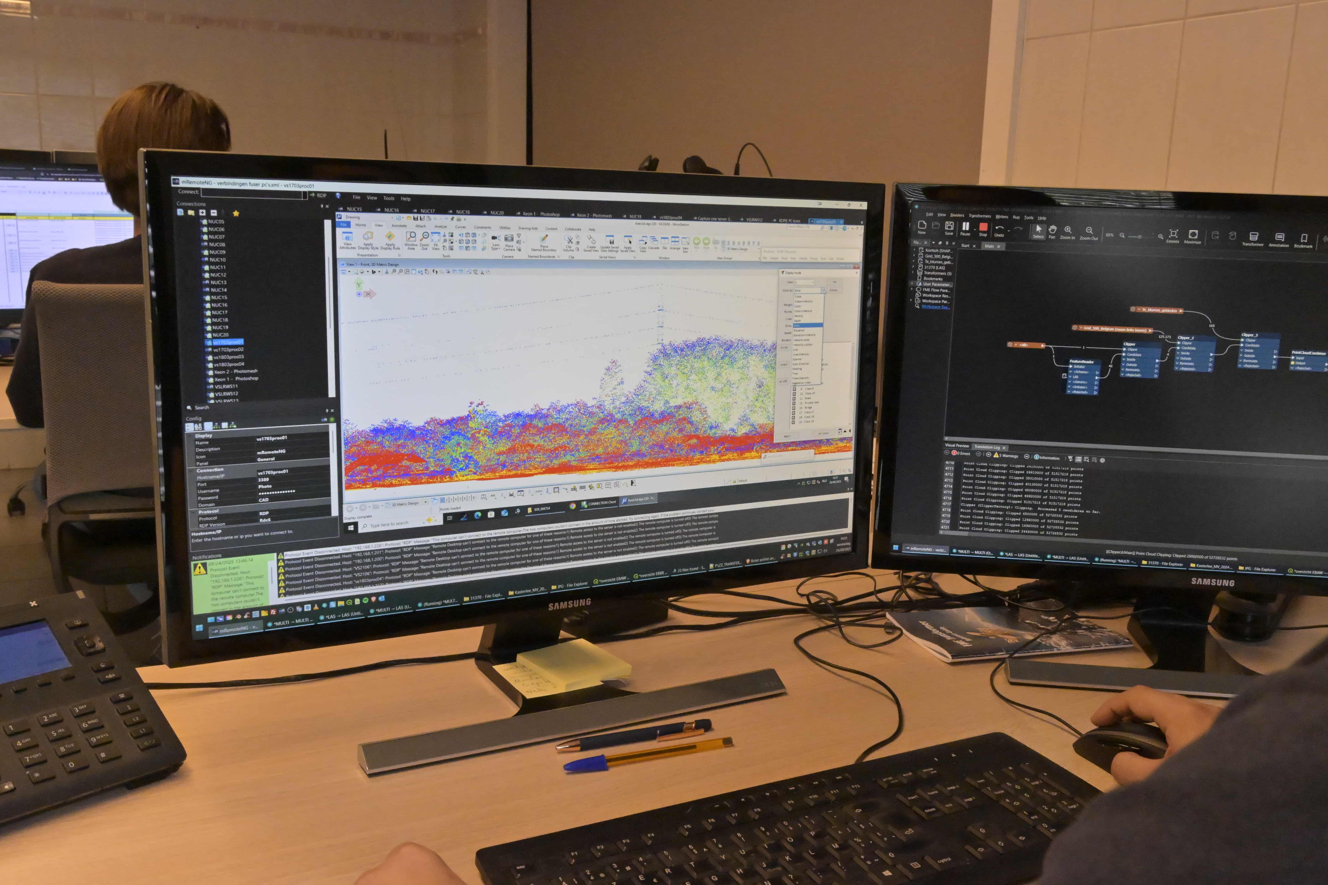
Our LiDAR data is delivered as standard in LAS/LAZ or E57 format, directly via our FTP server. The datasets are also integrated into the base license of our Plan3D Webviewer, allowing you to visualise and analyse them quickly without additional software.
We guarantee on-time delivery, full transparency in planning and consistent quality across all projects. Because we manage the entire process in-house, we can respond flexibly to specific needs and ensure that every dataset is immediately ready to use for your GIS, BIM (Building Information Modelling) or AI application.


Our LiDAR Point Clouds can be fully classified, so that every point, whether from a building, terrain, vegetation or infrastructure, is immediately identifiable. This makes the dataset ready for use in a wide range of applications: from automated object detection and volume calculations to DTM (Digital Terrain Model) and DSM (Digital Surface Model) analysis. This preprocessing saves valuable time in data analysis and gives you a structured, reliable basis for your GIS or 3D projects right away.
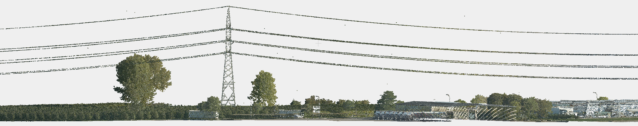
Our aerial LiDAR can be seamlessly combined with terrestrial (ground) LiDAR, resulting in a complete and highly accurate 3D view of the environment. This gives you the best of both worlds: the broad coverage of aerial surveys combined with the fine detail resolution of ground scans. These combined datasets are particularly valuable for urban modelling, infrastructure inspections, asset management and construction projects, where both context and detail are crucial.

The point cloud can be delivered per tile, per project area or for a complete region, fully clipped to your defined boundary. We can also classify the dataset according to standard classification or as agreed, and deliver it via hard drive or FTP in common file formats. This ensures the data fits perfectly into your workflow and scale of operations.
Our LiDAR Point Clouds can be fully classified, so that every point, whether from a building, terrain, vegetation or infrastructure, is immediately identifiable. This makes the dataset ready for use in a wide range of applications: from automated object detection and volume calculations to DTM (Digital Terrain Model) and DSM (Digital Surface Model) analysis. This preprocessing saves valuable time in data analysis and gives you a structured, reliable basis for your GIS or 3D projects right away.
Our aerial LiDAR can be seamlessly combined with terrestrial (ground) LiDAR, resulting in a complete and highly accurate 3D view of the environment. This gives you the best of both worlds: the broad coverage of aerial surveys combined with the fine detail resolution of ground scans. These combined datasets are particularly valuable for urban modelling, infrastructure inspections, asset management and construction projects, where both context and detail are crucial.
The point cloud can be delivered per tile, per project area or for a complete region, fully clipped to your defined boundary. We can also classify the dataset according to standard classification or as agreed, and deliver it via hard drive or FTP in common file formats. This ensures the data fits perfectly into your workflow and scale of operations.

By 2040, Flanders must be asbestos-safe. Our aerial imagery and Deep Learning flag which roofs are suspected per address, so we can work together efficiently towards a healthier and safer living environment.
read more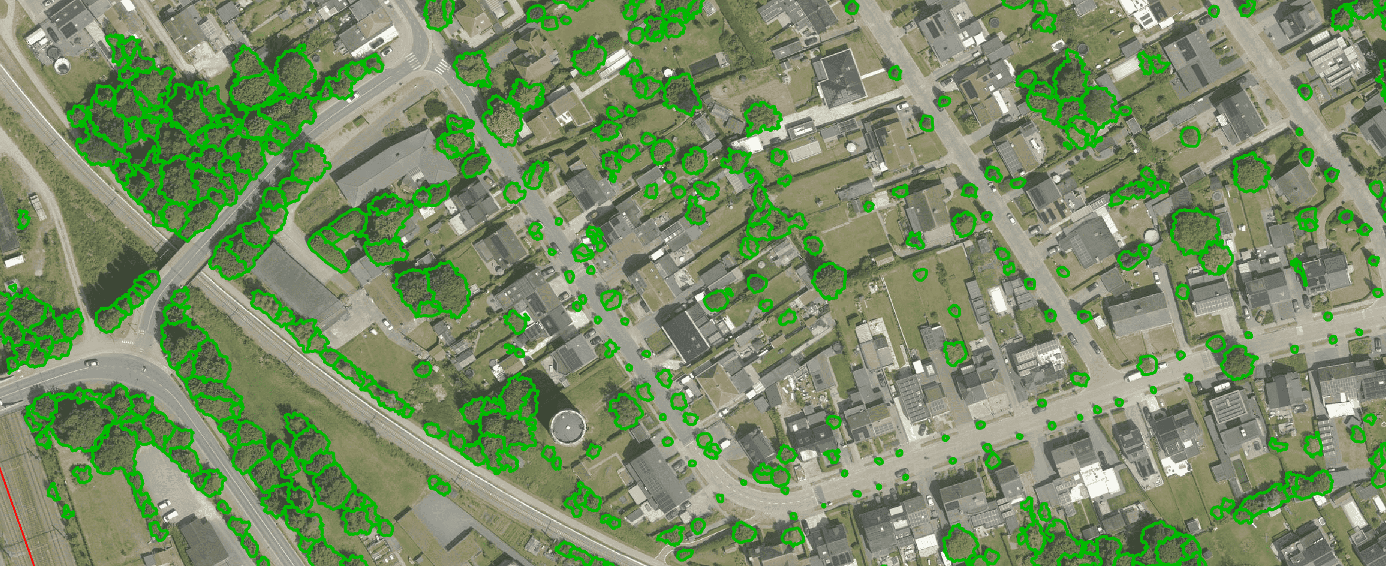
Get a complete overview of trees in your area, including individual characteristics such as crown area and height, and use the data to apply the European 3-30-300 rule for optimal urban greening. Ideal for municipalities, planners and green space managers who need accurate, scalable and policy-relevant geospatial data
read more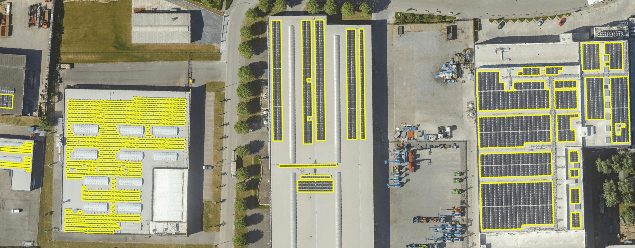
Get a detailed map layer of solar panels at building or cluster level, including surface area calculations per cluster. Ideal for anyone working with geospatial data who wants insight into energy potential and roof utilisation.
read more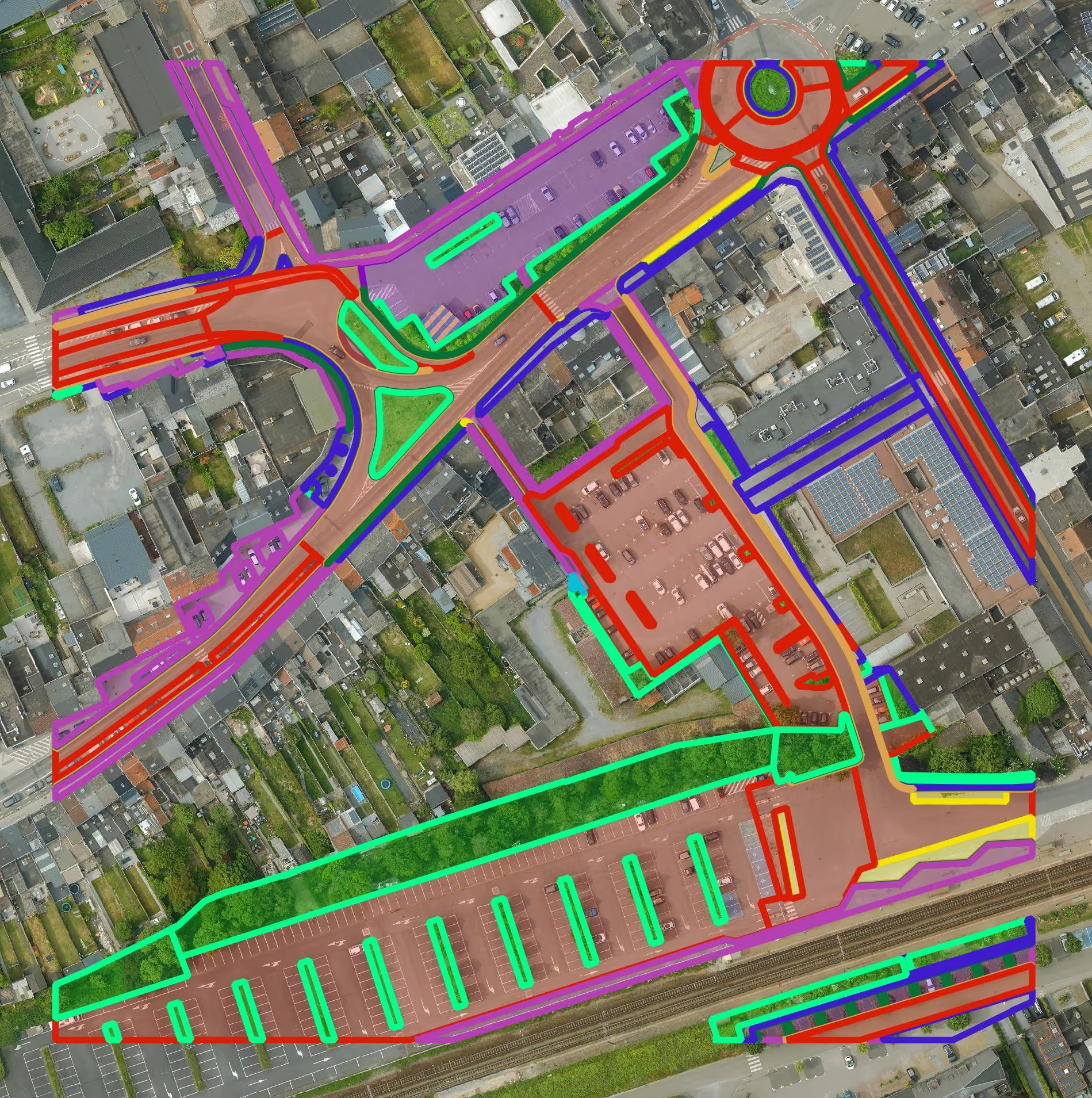
Get a detailed map layer of the public space with classification by object and material. Ideal for anyone working with geospatial data who needs more detail than existing reference data provides.
read more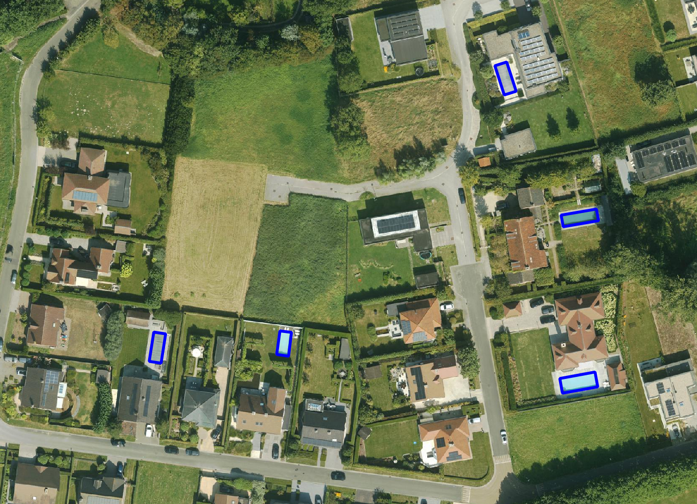
Get a detailed map layer of swimming pools at parcel or object level, including surface area calculations. Ideal for anyone using geospatial data for policy analysis, permits or trend research.
read more
Get a complete inventory of all road markings within your project area, classified into objects, lines and surfaces and linked to the correct underlying surface. This gives you objective data to support maintenance planning, reporting and policy decisions around mobility and asset management.
read more
Our paved/unpaved surface maps provide a complete and objective overview of where the ground is paved or unpaved, in both private and public space.
read moreEvery possible element of a cemetery is mapped. The result is a clear and organised plan that supports efficient and transparent cemetery management.
read more
Do you need a specific inventory that is not yet in our offering? We develop custom inventories tailored to your project. Thanks to our experience with aerial imagery and Deep Learning, we can detect and map almost any object type. Get in touch to discuss the possibilities.
Get in touchBy 2040, Flanders must be asbestos-safe. Our aerial imagery and Deep Learning flag which roofs are suspected per address, so we can work together efficiently towards a healthier and safer living environment.
read moreGet a complete overview of trees in your area, including individual characteristics such as crown area and height, and use the data to apply the European 3-30-300 rule for optimal urban greening. Ideal for municipalities, planners and green space managers who need accurate, scalable and policy-relevant geospatial data.
read moreGet a detailed map layer of solar panels at building or cluster level, including surface area calculations per cluster. Ideal for anyone working with geospatial data who wants insight into energy potential and roof utilisation.
read more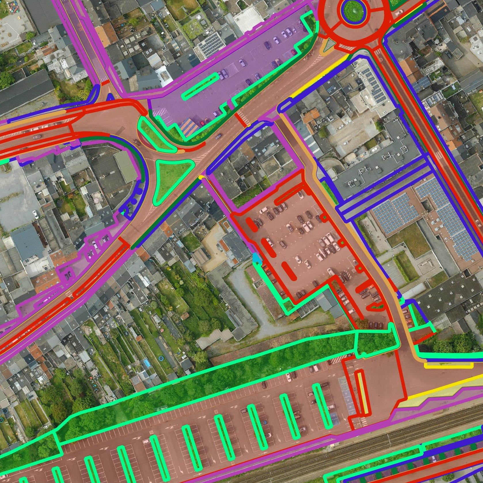
Get a detailed map layer of the public space with classification by object and material. Ideal for anyone working with geospatial data who needs more detail than existing reference data provides.
read moreGet a detailed map layer of swimming pools at parcel or object level, including surface area calculations. Ideal for anyone using geospatial data for policy analysis, permits or trend research.
read moreGet a complete inventory of all road markings within your project area, classified into objects, lines and surfaces and linked to the correct underlying surface. This gives you objective data to support maintenance planning, reporting and policy decisions around mobility and asset management.
read moreOur pavement surface maps provide a complete and objective overview of where the ground is paved or unpaved, in both private and public space.
read moreEvery possible element of a cemetery is mapped. The result is a clear and organised plan that supports efficient and transparent cemetery management.
read moreDo you need a specific inventory that is not yet in our offering? We develop custom inventories tailored to your project. Thanks to our experience with aerial imagery and Deep Learning, we can detect and map almost any object type. Get in touch to discuss the possibilities.
Get in touch
Use our dense, accurate LiDAR Point Cloud data for spatial planning, water management and policy analyses.
Use accurate LiDAR Point Cloud data to support investment decisions, assess site conditions and manage your infrastructure assets. From volume calculations to capacity planning, reliable 3D input reduces risk and improves outcomes across your projects.

Integrate LiDAR Point Cloud data directly into your GIS or CAD environment and deliver more rigorous analyses, environmental impact assessments and technical studies for your clients — backed by high-density, georeferenced 3D data.
Use our dense, accurate LiDAR Point Cloud data for spatial planning, water management and policy analyses.
Use accurate LiDAR Point Cloud data to support investment decisions, assess site conditions and manage your infrastructure assets. From volume calculations to capacity planning, reliable 3D input reduces risk and improves outcomes across your projects.
Integrate LiDAR Point Cloud data directly into your GIS or CAD environment and deliver more rigorous analyses, environmental impact assessments and technical studies for your clients — backed by high-density, georeferenced 3D data.

