

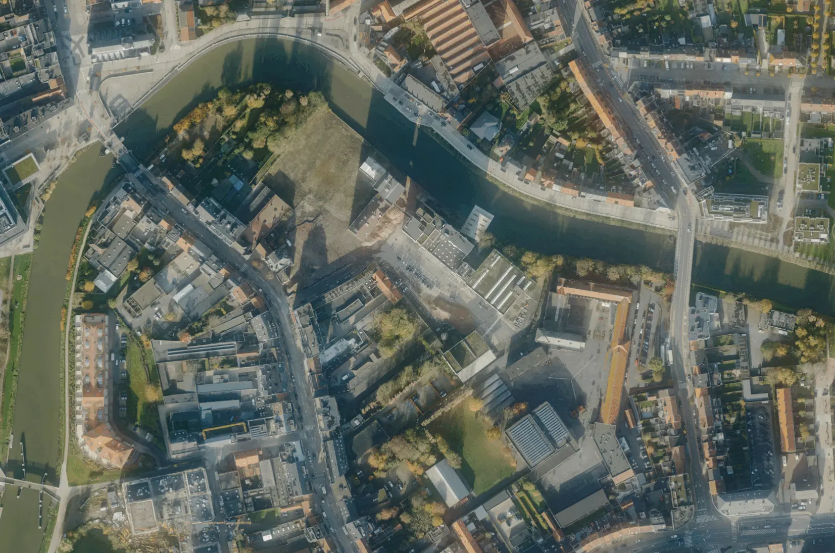
Our asbestos monitoring solution combines Deep Learning techniques, high-resolution True Orthophotos (GSD from 3 cm), oblique aerial images and the expertise of Fedasbest. This allows us to map per building (GRB — GBG & GBA) whether it is suspected of containing asbestos. Our model achieves an accuracy of 96.1% and supports policy objectives, such as realising an asbestos-safe Flanders by 2040, in an efficient way. Thanks to additional quality controls using street-level images and oblique aerial images, we guarantee a robust and reliable result.
We always deliver our data in the agreed formats, fully checked for quality and immediately ready for use. The dataset can be periodically renewed when new aerial imagery or inventories become available. We ensure that all delivered data integrates seamlessly into your own GIS environment.
Our detections are accurate and always verified through a thorough quality control process. There is always one dedicated point of contact available for support and integration into your systems.


.png)
Using aerial imagery and automated analysis we also detect roofs that are not visible during a site visit, such as garden sheds, outbuildings or warehouses at the rear of a property. This ensures no potential asbestos roof is missed and gives you a more complete picture of the situation.
Since 2018 we have been collecting highly detailed aerial imagery across Belgium, allowing you to analyse not only the current situation but also how it has evolved over time. When a new update is available, we can renew the dataset so you always have recent and reliable data and can track which roofs have since been remediated and where risks remain, without having to start from scratch each time.

Our detection model was developed in collaboration with certified asbestos experts and tuned to minimise false negatives (FN). This reduces the risk of suspected asbestos roofs being overlooked, making follow-up and remediation more efficient and safer. The model achieves 96.1% accuracy on validated test data for the category "asbestos suspected". Every update also goes through a quality control process, so the dataset can be reliably used for policy and implementation.
Using aerial imagery and automated analysis we also detect roofs that are not visible during a site visit, such as garden sheds, outbuildings or warehouses at the rear of a property. This ensures no potential asbestos roof is missed and gives you a more complete picture of the situation.
Since 2018 we have been collecting highly detailed aerial imagery across Belgium, allowing you to analyse not only the current situation but also how it has evolved over time. When a new update is available, we can renew the dataset so you always have recent and reliable data and can track which roofs have since been remediated and where risks remain, without having to start from scratch each time.
Our detection model was developed in collaboration with certified asbestos experts and tuned to minimise false negatives (FN). This reduces the risk of suspected asbestos roofs being overlooked, making follow-up and remediation more efficient and safer. The model achieves 96.1% accuracy on validated test data for the category "asbestos suspected". Every update also goes through a quality control process, so the dataset can be reliably used for policy and implementation.

By 2040, Flanders must be asbestos-safe. Our aerial imagery and Deep Learning flag which roofs are suspected per address, so we can work together efficiently towards a healthier and safer living environment.
read more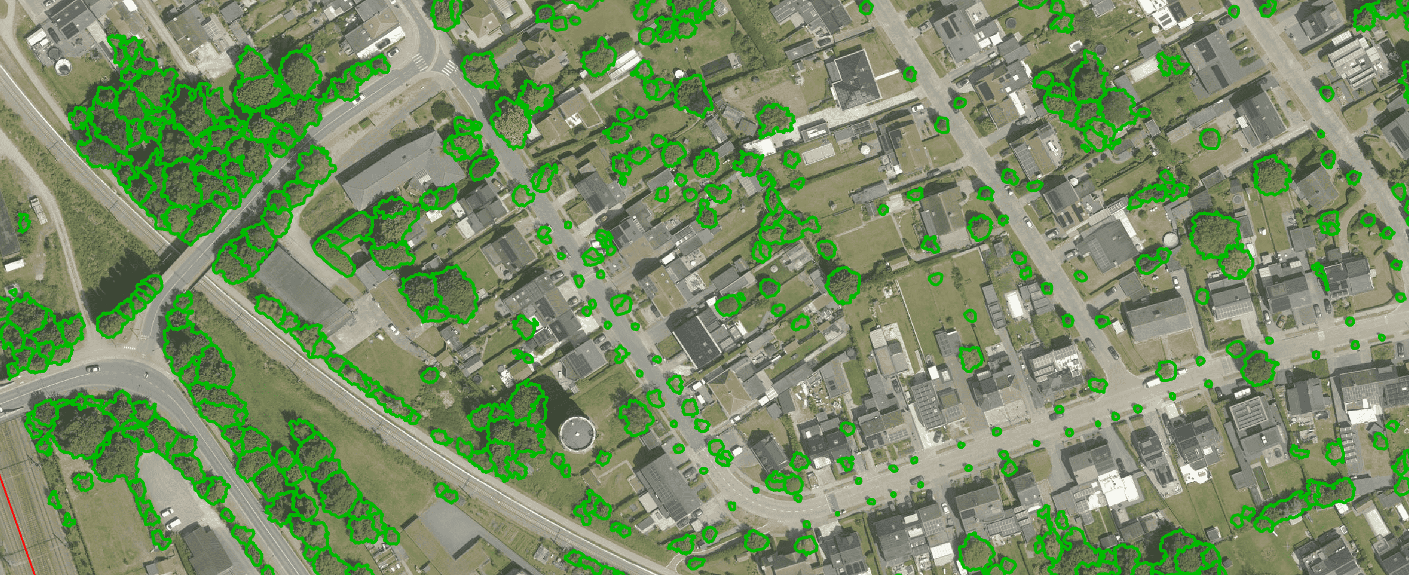
Get a complete overview of trees in your area, including individual characteristics such as crown area and height, and use the data to apply the European 3-30-300 rule for optimal urban greening. Ideal for municipalities, planners and green space managers who need accurate, scalable and policy-relevant geospatial data
read more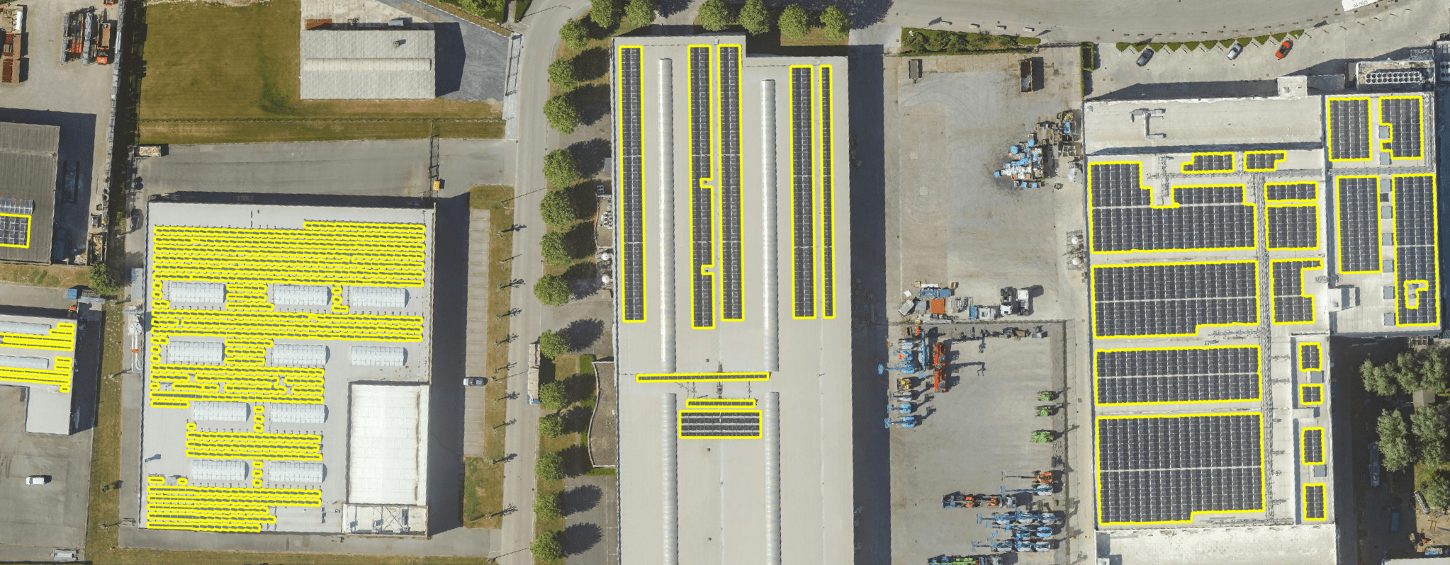
Get a detailed map layer of solar panels at building or cluster level, including surface area calculations per cluster. Ideal for anyone working with geospatial data who wants insight into energy potential and roof utilisation.
read more
Get a detailed map layer of the public space with classification by object and material. Ideal for anyone working with geospatial data who needs more detail than existing reference data provides.
read more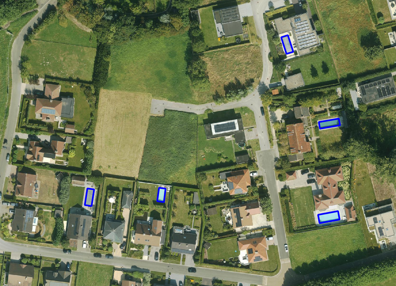
Get a detailed map layer of swimming pools at parcel or object level, including surface area calculations. Ideal for anyone using geospatial data for policy analysis, permits or trend research.
read more
Get a complete inventory of all road markings within your project area, classified into objects, lines and surfaces and linked to the correct underlying surface. This gives you objective data to support maintenance planning, reporting and policy decisions around mobility and asset management.
read more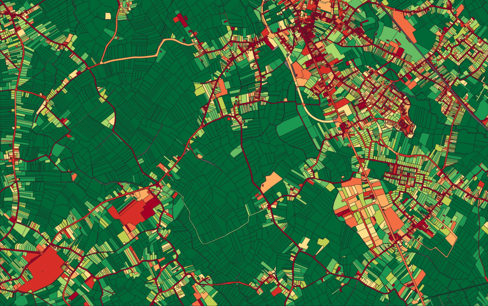
Our paved/unpaved surface maps provide a complete and objective overview of where the ground is paved or unpaved, in both private and public space.
read moreEvery possible element of a cemetery is mapped. The result is a clear and organised plan that supports efficient and transparent cemetery management.
read more
Do you need a specific inventory that is not yet in our offering? We develop custom inventories tailored to your project. Thanks to our experience with aerial imagery and Deep Learning, we can detect and map almost any object type. Get in touch to discuss the possibilities.
Get in touchBy 2040, Flanders must be asbestos-safe. Our aerial imagery and Deep Learning flag which roofs are suspected per address, so we can work together efficiently towards a healthier and safer living environment.
read moreGet a complete overview of trees in your area, including individual characteristics such as crown area and height, and use the data to apply the European 3-30-300 rule for optimal urban greening. Ideal for municipalities, planners and green space managers who need accurate, scalable and policy-relevant geospatial data.
read moreGet a detailed map layer of solar panels at building or cluster level, including surface area calculations per cluster. Ideal for anyone working with geospatial data who wants insight into energy potential and roof utilisation.
read more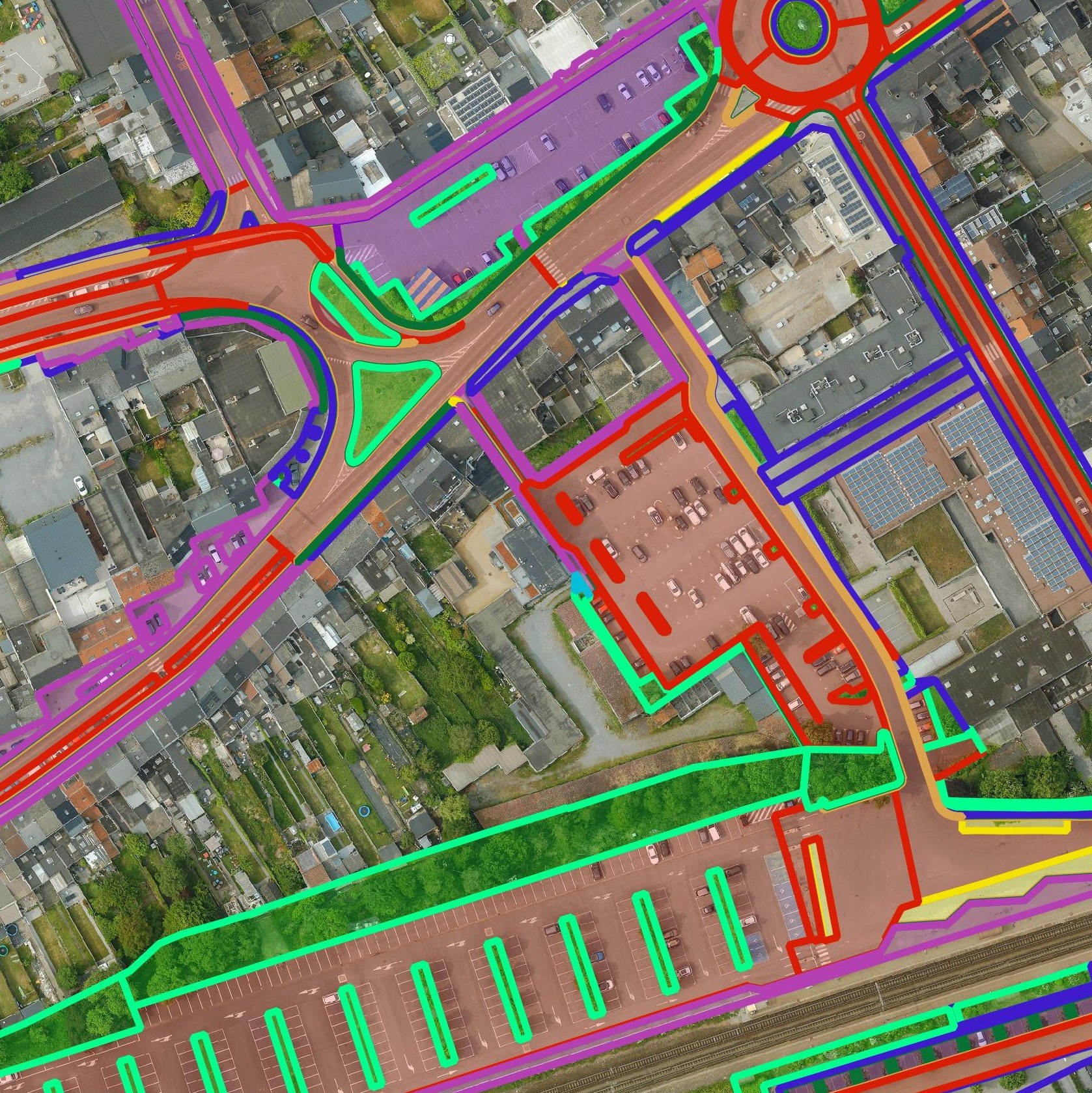
Get a detailed map layer of the public space with classification by object and material. Ideal for anyone working with geospatial data who needs more detail than existing reference data provides.
read moreGet a detailed map layer of swimming pools at parcel or object level, including surface area calculations. Ideal for anyone using geospatial data for policy analysis, permits or trend research.
read moreGet a complete inventory of all road markings within your project area, classified into objects, lines and surfaces and linked to the correct underlying surface. This gives you objective data to support maintenance planning, reporting and policy decisions around mobility and asset management.
read moreOur pavement surface maps provide a complete and objective overview of where the ground is paved or unpaved, in both private and public space.
read moreEvery possible element of a cemetery is mapped. The result is a clear and organised plan that supports efficient and transparent cemetery management.
read moreDo you need a specific inventory that is not yet in our offering? We develop custom inventories tailored to your project. Thanks to our experience with aerial imagery and Deep Learning, we can detect and map almost any object type. Get in touch to discuss the possibilities.
Get in touch
Support policy on asbestos phase-out with an area-wide overview. Thanks to the high reliability (96.1% accuracy of the Deep Learning model for suspected asbestos roofs) you avoid unnecessary communication to residents and can prioritise where the risk is greatest.

Manage asbestos inventories at a supra-local level with one central dataset. This allows you to support multiple municipalities simultaneously, standardise reporting and steer remediation programmes more efficiently.

Get reliable data for monitoring and reporting on asbestos phase-out. The periodic updates make it possible to track developments and align measures with current needs.
Support policy on asbestos phase-out with an area-wide overview. Thanks to the high reliability (96.1% accuracy of the Deep Learning model for suspected asbestos roofs) you avoid unnecessary communication to residents and can prioritise where the risk is greatest.
Manage asbestos inventories at a supra-local level with one central dataset. This allows you to support multiple municipalities simultaneously, standardise reporting and steer remediation programmes more efficiently.
Get reliable data for monitoring and reporting on asbestos phase-out. The periodic updates make it possible to track developments and align measures with current needs.

