
Naast de standaardlicentie van de Plan3D Webviewer bieden we een reeks extra services aan die jouw data-analyse en visualisatie nog krachtiger maken. We staan altijd open voor suggesties en denken graag mee over maatwerkopties in de Plan3D Webviewer. Vraag een offerte aan, stel extra services voor of boek een demo om alle mogelijkheden te ontdekken via ons contactformulier.
In addition to the standard Plan3D Webviewer license, we offer a range of extra services, such as Big Data and the integration of true orthophotos and oblique images into your GIS environment. These services make your data analysis and visualisation more powerful. We are happy to collaborate on custom sollutions within the Plan3D Webviewer. Request a quote, propose extra services or book a demo to discover all the possibilities via our contact form.
The upgrades are added to your existing Plan3D Webviewer account. No additional software needs to be installed. After activation, the extra features are immediately available in the same familiar environment.
We guarantee that the extra services integrate seamlessly with your existing Plan3D Webviewer and are fully tested in our stable and user-friendly environment.


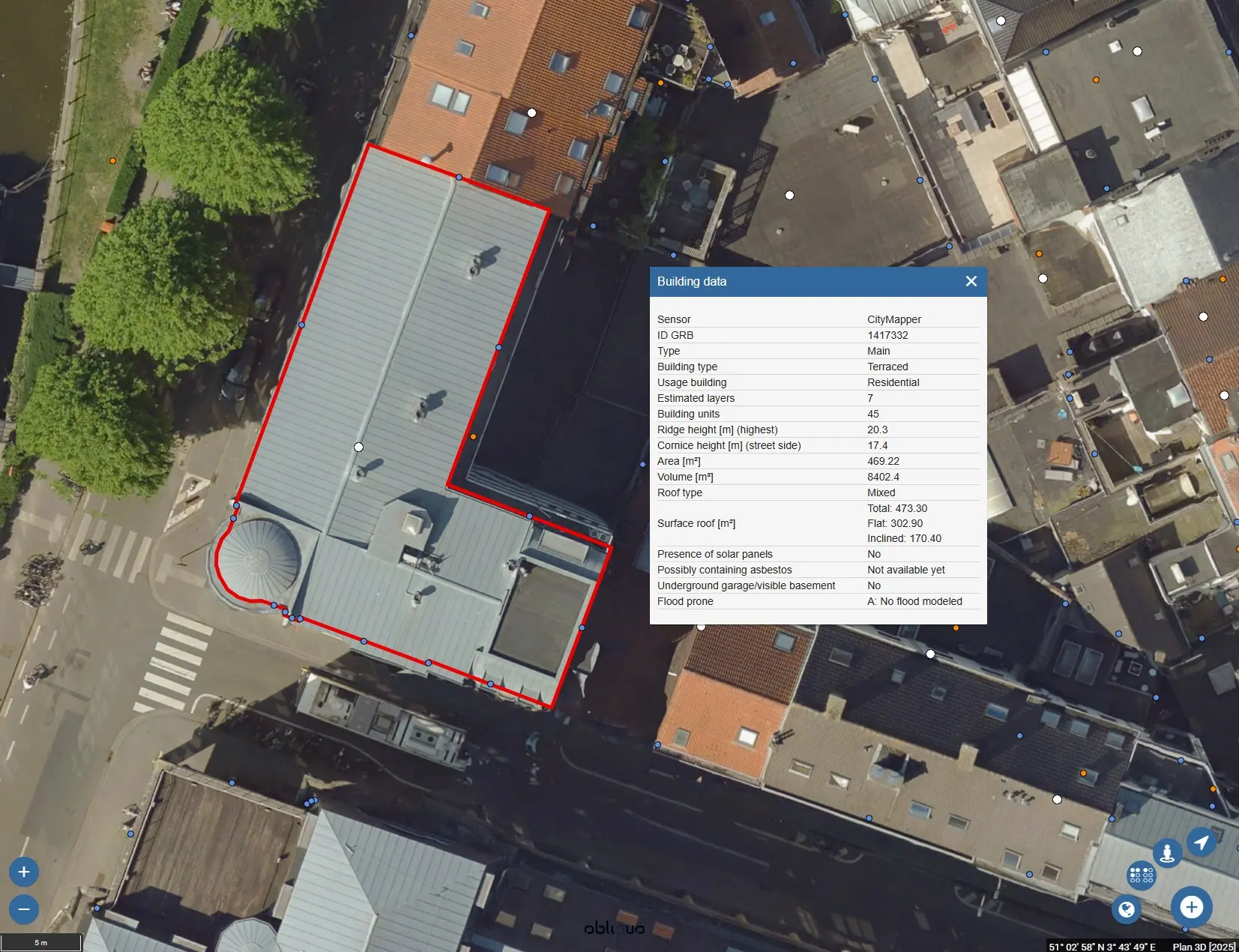
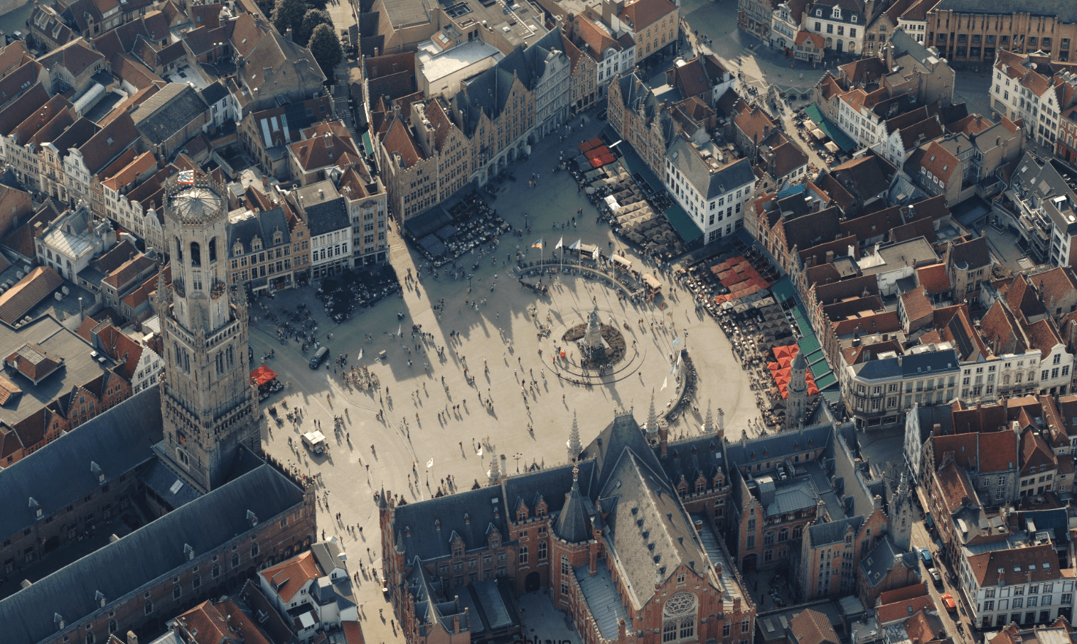
With our extra Big Data services you get a complete and detailed view of buildings, facades, parcels and sites, enriched with calculations based on our own LiDAR aerial surveys and official map layers such as GRB (Large-Scale Reference Database), PICC (Wallonia) and URBIS (Brussels). Our datasets are supplemented with AI-based analyses that automatically detect solar panels, asbestos roofs and swimming pools, combined with data from external sources. This enriched information is fully integrated into the Plan3D Webviewer and can be activated as an extra layer, so you can consult and analyse all insights directly in the viewer.
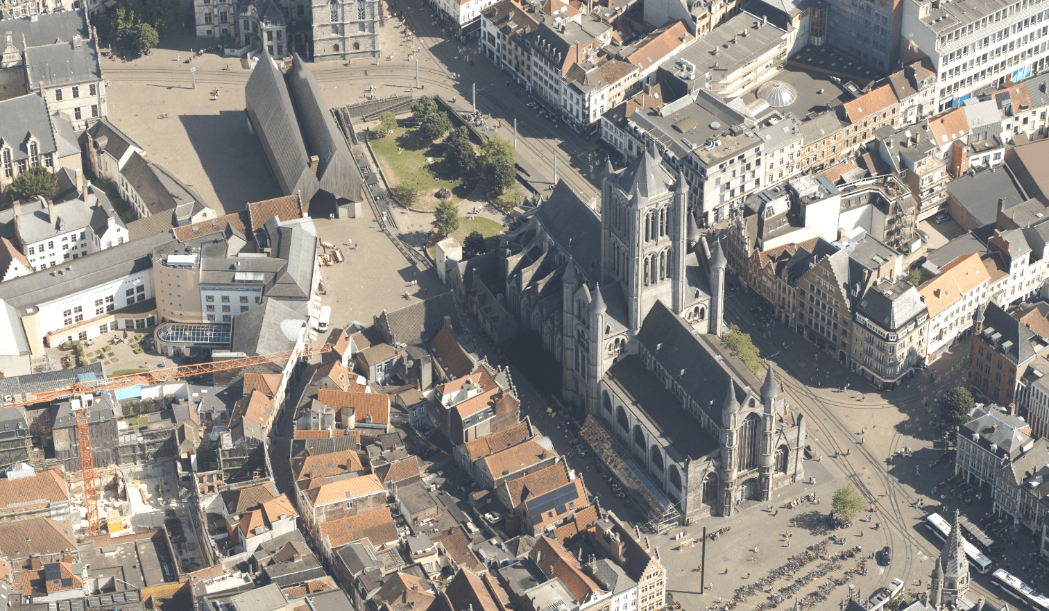
Via WMS (Web Map Service) we provide historical orthophoto data going back to 2017 and provincial image mosaics, so you always have access to all versions of cities and municipalities in one clear layer. Our WMS orthophotos load much faster than local files, as the data is hosted and streamed per tile. Access is secured via username/password authentication or IP restrictions, giving you direct access to up-to-date and reliable orthophotos.
The Obliques API integrates oblique imagery seamlessly into your GIS environment and the Plan3D Webviewer.This combines angled imagery with your data for accurate analysis, inspection, and visualisation.
With our extra Big Data services you get a complete and detailed view of buildings, facades, parcels and sites, enriched with calculations based on our own LiDAR aerial surveys and official map layers such as GRB (Large-Scale Reference Database), PICC (Wallonia) and URBIS (Brussels). Our datasets are supplemented with AI-based analyses that automatically detect solar panels, asbestos roofs and swimming pools, combined with data from external sources. This enriched information is fully integrated into the Plan3D Webviewer and can be activated as an extra layer, so you can consult and analyse all insights directly in the viewer.
Via WMS (Web Map Service) we provide historical orthophoto data going back to 2017 and provincial image mosaics, so you always have access to all versions of cities and municipalities in one clear layer. Our WMS orthophotos load much faster than local files, as the data is hosted and streamed per tile. Access is secured via username/password authentication or IP restrictions, giving you direct access to up-to-date and reliable orthophotos.
The Obliques API integrates oblique imagery seamlessly into your GIS environment and the Plan3D Webviewer.This combines angled imagery with your data for accurate analysis, inspection, and visualisation.

By 2040, Flanders must be asbestos-safe. Our aerial imagery and Deep Learning flag which roofs are suspected per address, so we can work together efficiently towards a healthier and safer living environment.
read more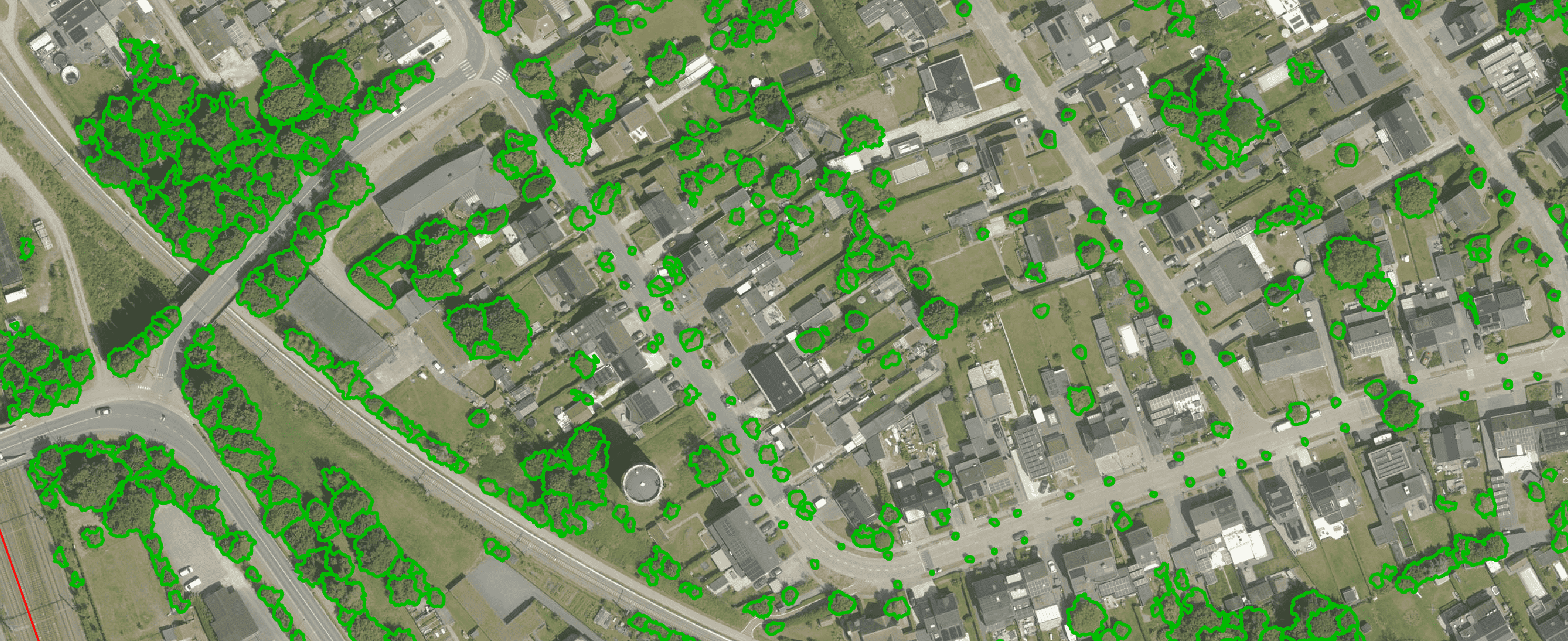
Get a complete overview of trees in your area, including individual characteristics such as crown area and height, and use the data to apply the European 3-30-300 rule for optimal urban greening. Ideal for municipalities, planners and green space managers who need accurate, scalable and policy-relevant geospatial data
read more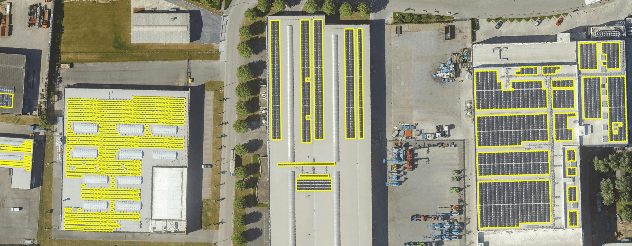
Get a detailed map layer of solar panels at building or cluster level, including surface area calculations per cluster. Ideal for anyone working with geospatial data who wants insight into energy potential and roof utilisation.
read more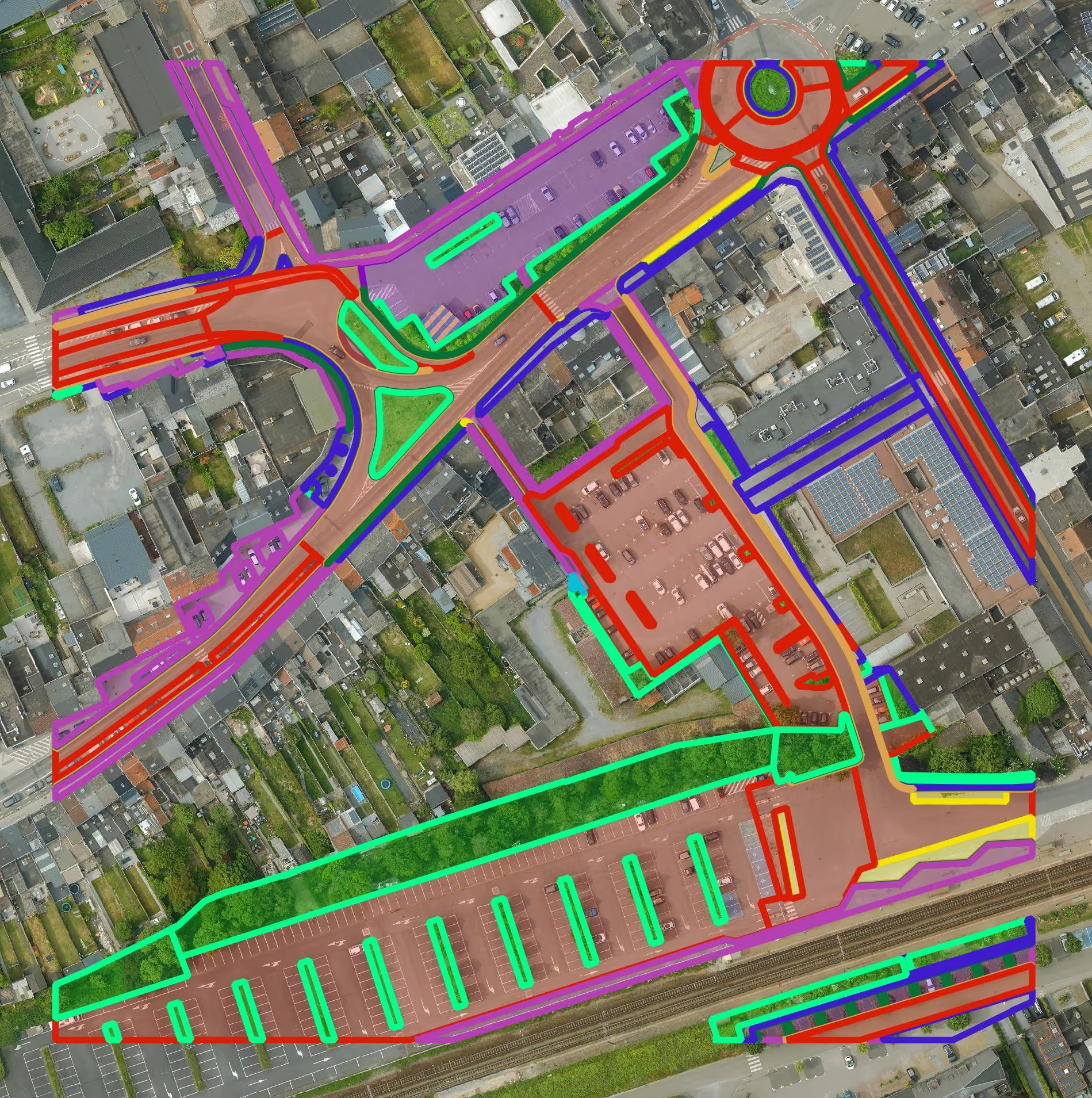
Get a detailed map layer of the public space with classification by object and material. Ideal for anyone working with geospatial data who needs more detail than existing reference data provides.
read more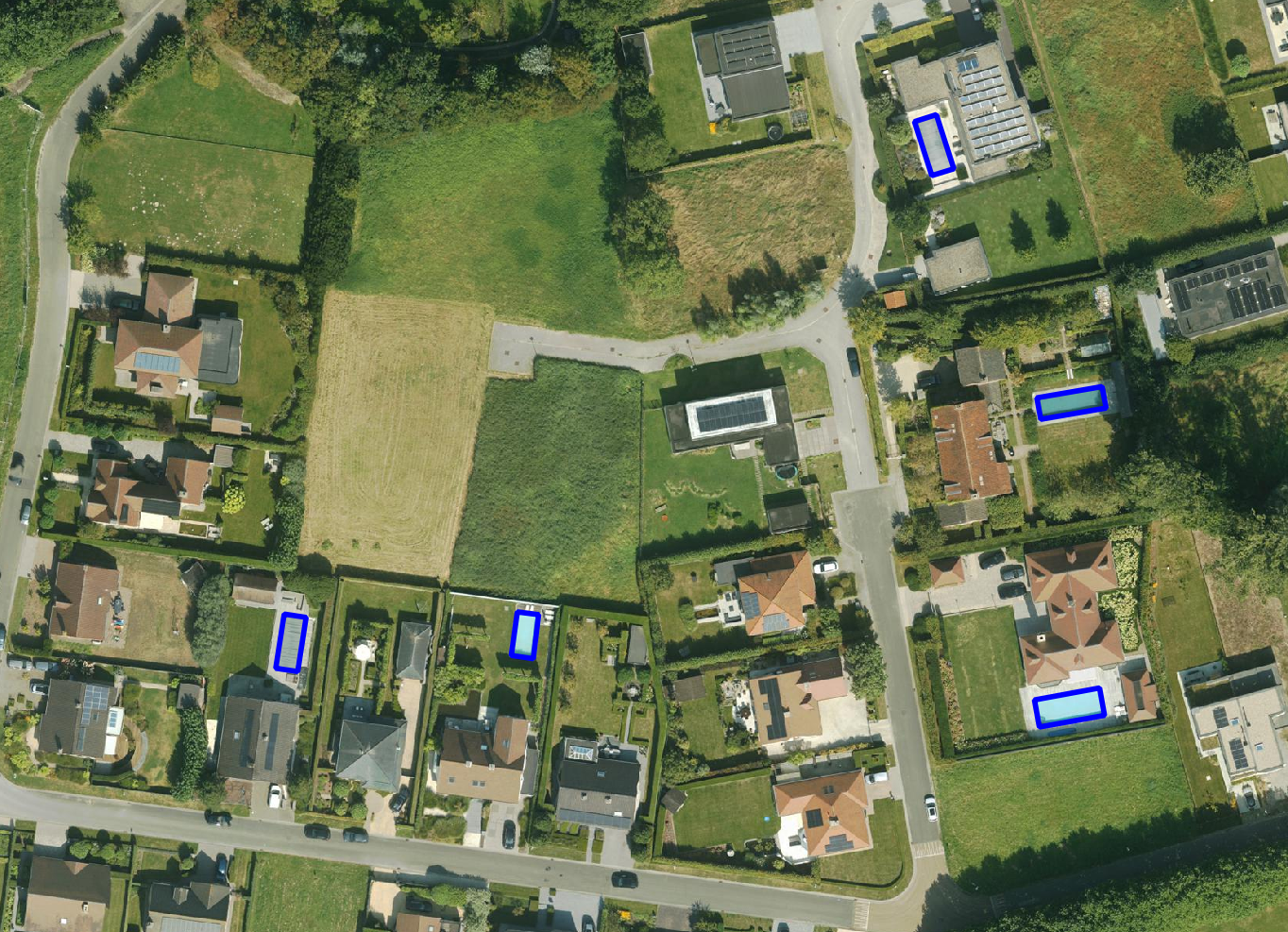
Get a detailed map layer of swimming pools at parcel or object level, including surface area calculations. Ideal for anyone using geospatial data for policy analysis, permits or trend research.
read more
Get a complete inventory of all road markings within your project area, classified into objects, lines and surfaces and linked to the correct underlying surface. This gives you objective data to support maintenance planning, reporting and policy decisions around mobility and asset management.
read more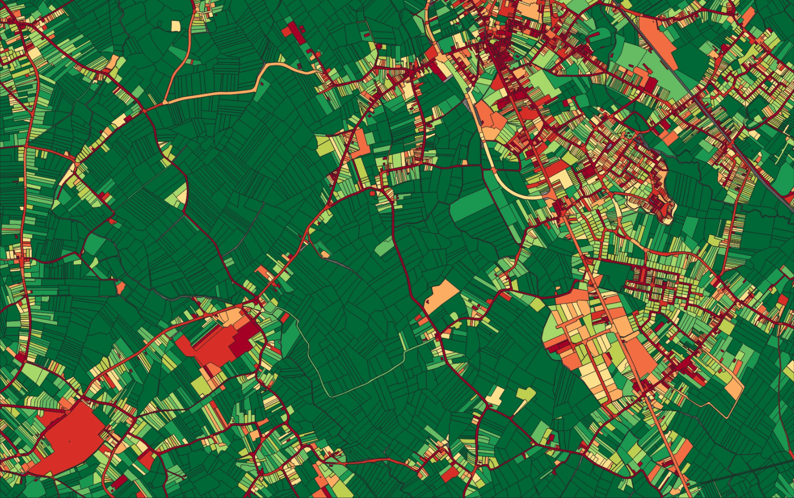
Our paved/unpaved surface maps provide a complete and objective overview of where the ground is paved or unpaved, in both private and public space.
read moreEvery possible element of a cemetery is mapped. The result is a clear and organised plan that supports efficient and transparent cemetery management.
read more
Do you need a specific inventory that is not yet in our offering? We develop custom inventories tailored to your project. Thanks to our experience with aerial imagery and Deep Learning, we can detect and map almost any object type. Get in touch to discuss the possibilities.
Get in touchBy 2040, Flanders must be asbestos-safe. Our aerial imagery and Deep Learning flag which roofs are suspected per address, so we can work together efficiently towards a healthier and safer living environment.
read moreGet a complete overview of trees in your area, including individual characteristics such as crown area and height, and use the data to apply the European 3-30-300 rule for optimal urban greening. Ideal for municipalities, planners and green space managers who need accurate, scalable and policy-relevant geospatial data.
read moreGet a detailed map layer of solar panels at building or cluster level, including surface area calculations per cluster. Ideal for anyone working with geospatial data who wants insight into energy potential and roof utilisation.
read more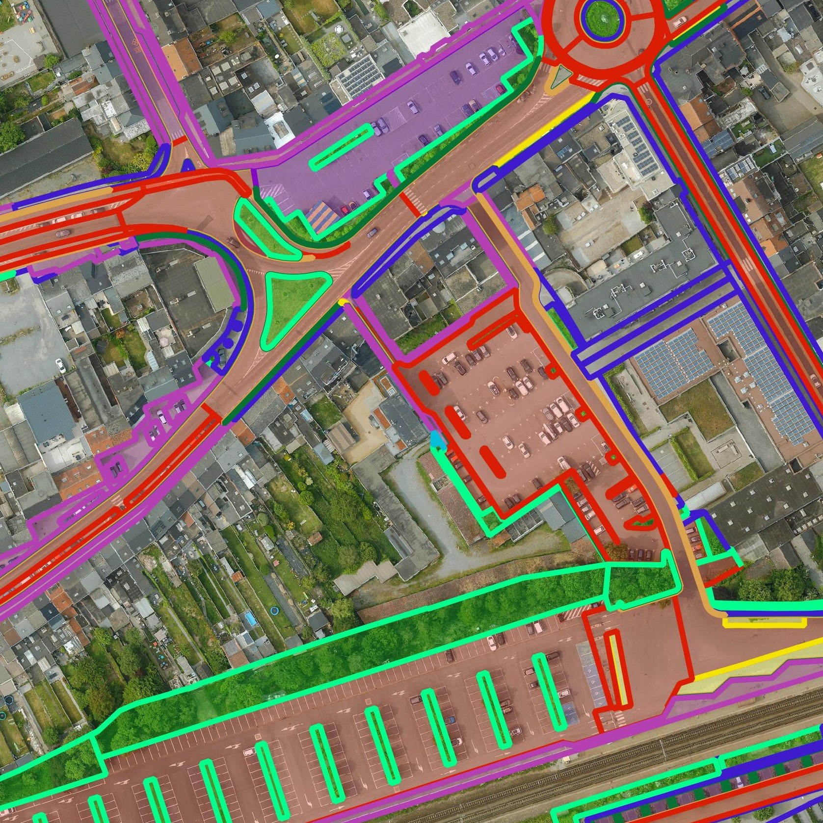
Get a detailed map layer of the public space with classification by object and material. Ideal for anyone working with geospatial data who needs more detail than existing reference data provides.
read moreGet a detailed map layer of swimming pools at parcel or object level, including surface area calculations. Ideal for anyone using geospatial data for policy analysis, permits or trend research.
read moreGet a complete inventory of all road markings within your project area, classified into objects, lines and surfaces and linked to the correct underlying surface. This gives you objective data to support maintenance planning, reporting and policy decisions around mobility and asset management.
read moreOur pavement surface maps provide a complete and objective overview of where the ground is paved or unpaved, in both private and public space.
read moreEvery possible element of a cemetery is mapped. The result is a clear and organised plan that supports efficient and transparent cemetery management.
read moreDo you need a specific inventory that is not yet in our offering? We develop custom inventories tailored to your project. Thanks to our experience with aerial imagery and Deep Learning, we can detect and map almost any object type. Get in touch to discuss the possibilities.
Get in touch

