
De Plan3D Webviewer bundelt al onze luchtbeelden en 3D-data in één gebruiksvriendelijke online omgeving voor heel België. Je kunt er eenvoudig afstanden en oppervlaktes meten, terreinprofielen bekijken en je eigen bestanden toevoegen. Dankzij de webbased interface heb je geen GIS-software of technische kennis nodig. Je werkt altijd met de meest actuele en gedetailleerde gegevens, waardoor inspecties en analyses snel en betrouwbaar verlopen. Voor wie nog meer uit de webviewer wil halen, zijn er extra Plan3D services. Vraag vandaag nog je testlicentie aan en test het zelf!
The Plan3D Webviewer brings together all our aerial imagery and geospatial data in one user-friendly online environment covering the whole of Belgium. You can easily measure distances and surface areas, view terrain profiles and add your own files. Thanks to the web-based interface, no GIS software or technical knowledge is needed. You always work with the most current and detailed data, making inspections and analyses fast and reliable. For those who want to get even more out of the viewer, there are extra Plan3D services.
Request a demo and discover our solution with a free trial account.
Access to the Plan3D Webviewer is entirely web-based, with no additional software to install. You receive a personal login and can get started right away. No local storage or extra hardware is needed — all data is securely stored on our servers, protected and available around the clock, 24/7.
We guarantee a user-friendly, up-to-date and stable web environment that anyone can use straight away, without technical knowledge. We also offer free demos, online or on-site, so you and your team can discover the full potential of the platform. Once you have your Plan3D license, we provide a tailored training session packed with tips and tricks, with the latest features explained through real-world examples. Our support team is always on hand — you get direct, personal assistance whenever you need it.


The Plan3D Webviewer is accessible to everyone. No technical knowledge or GIS experience is needed. The intuitive interface makes it easy to take measurements, view terrain profiles and analyse data — all directly in your browser.
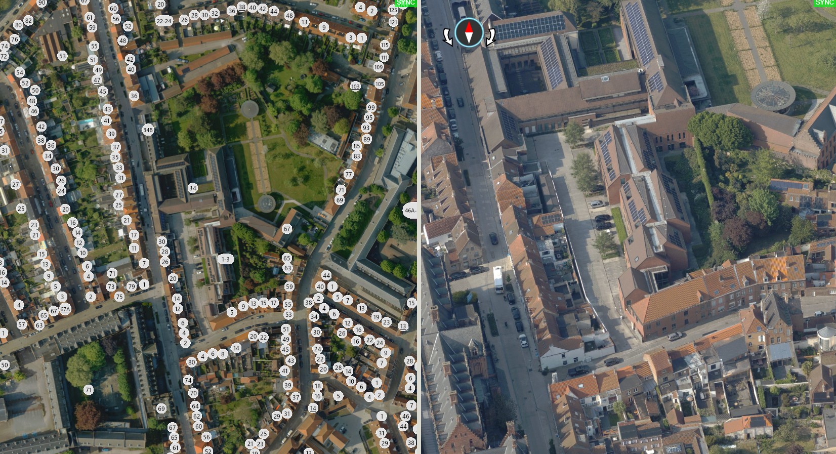
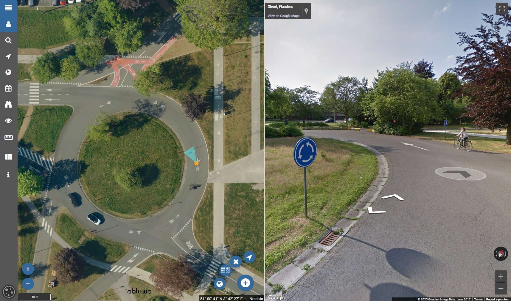
The Plan3D Webviewer brings together our own true orthophotos (from 3 cm GSD), oblique images and LiDAR Point Cloud data alongside Google Street View imagery in a single platform. View the same location from multiple perspectives for better context and more confident results. You can also import your own GIS data — such as Shapefiles — for temporary internal use, or integrate it as a permanent layer for continuous access.
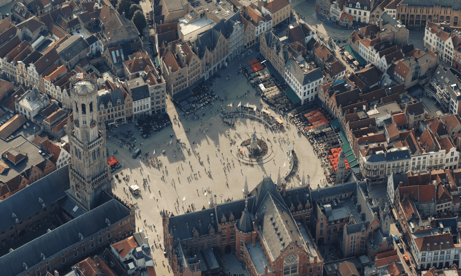
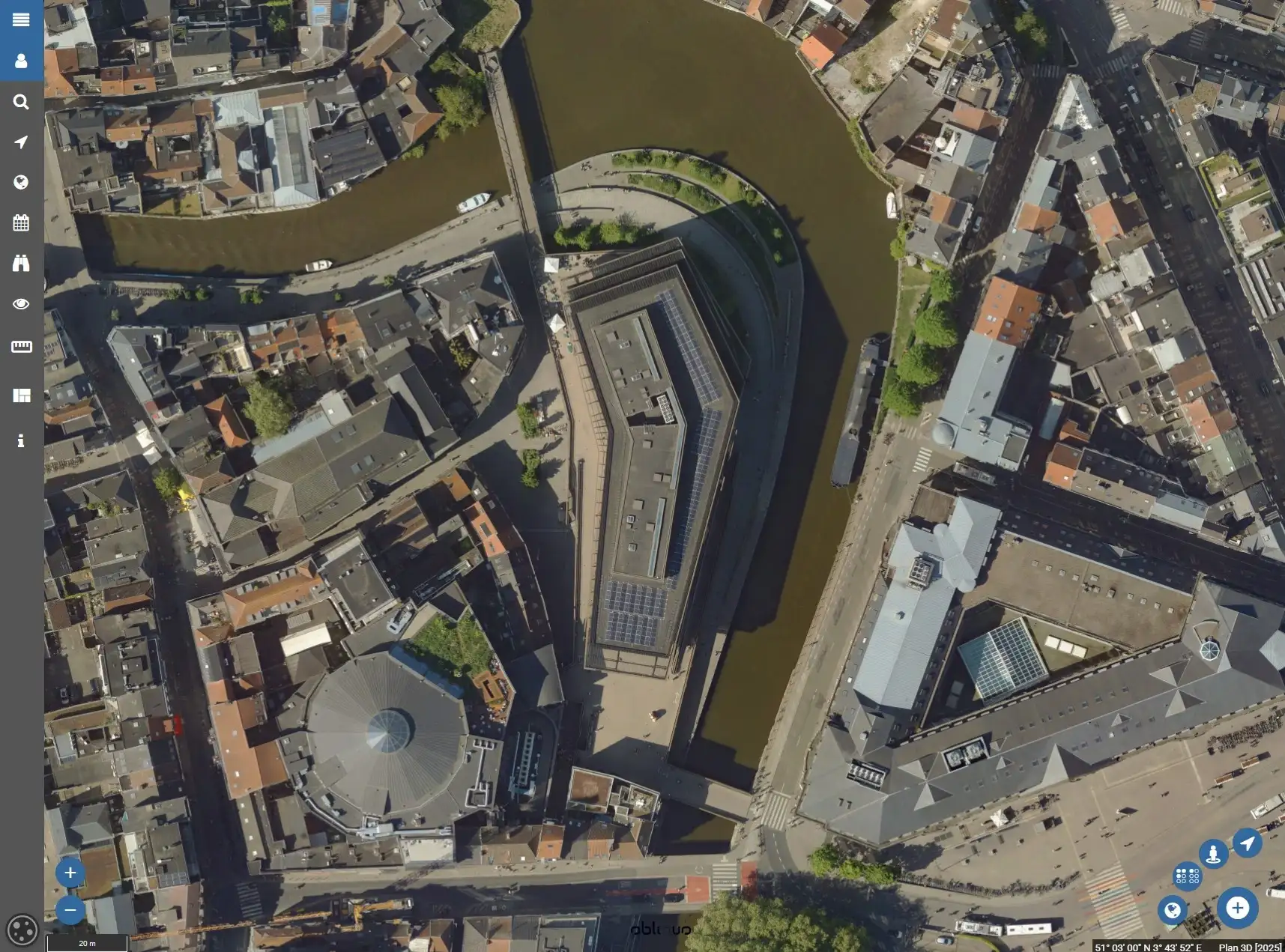
The oblique images in our Plan3D Webviewer offer a realistic and detailed perspective on any location. The angled viewpoint gives you more context and depth than traditional orthophotos. They allow you to accurately analyse facades, roof structures and objects without visiting the site. An invaluable asset for anyone who wants to combine visual insight with precision.
The Plan3D Webviewer is accessible to everyone. No technical knowledge or GIS experience is needed. The intuitive interface makes it easy to take measurements, view terrain profiles and analyse data — all directly in your browser.
The Plan3D Webviewer brings together our own true orthophotos (from 3 cm GSD), oblique images and LiDAR Point Cloud data alongside Google Street View imagery in a single platform. View the same location from multiple perspectives for better context and more confident results. You can also import your own GIS data — such as Shapefiles — for temporary internal use, or integrate it as a permanent layer for continuous access.
The oblique images in our Plan3D Webviewer offer a realistic and detailed perspective on any location. The angled viewpoint gives you more context and depth than traditional orthophotos. They allow you to accurately analyse facades, roof structures and objects without visiting the site. An invaluable asset for anyone who wants to combine visual insight with precision.

By 2040, Flanders must be asbestos-safe. Our aerial imagery and Deep Learning flag which roofs are suspected per address, so we can work together efficiently towards a healthier and safer living environment.
read more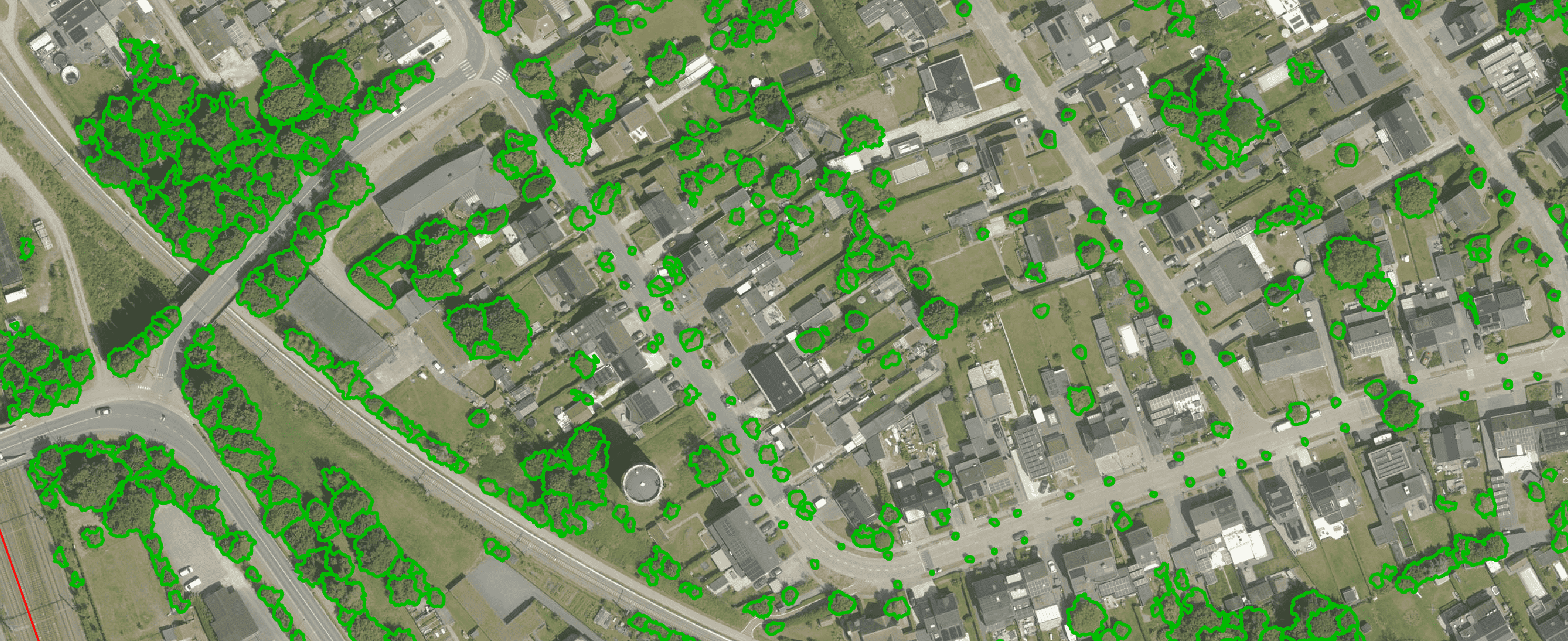
Get a complete overview of trees in your area, including individual characteristics such as crown area and height, and use the data to apply the European 3-30-300 rule for optimal urban greening. Ideal for municipalities, planners and green space managers who need accurate, scalable and policy-relevant geospatial data
read more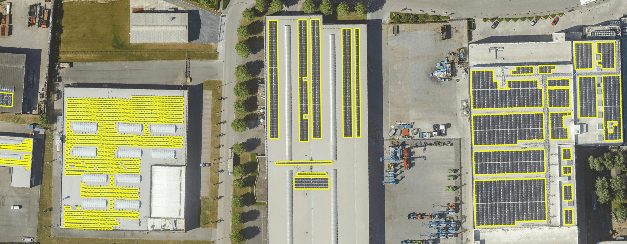
Get a detailed map layer of solar panels at building or cluster level, including surface area calculations per cluster. Ideal for anyone working with geospatial data who wants insight into energy potential and roof utilisation.
read more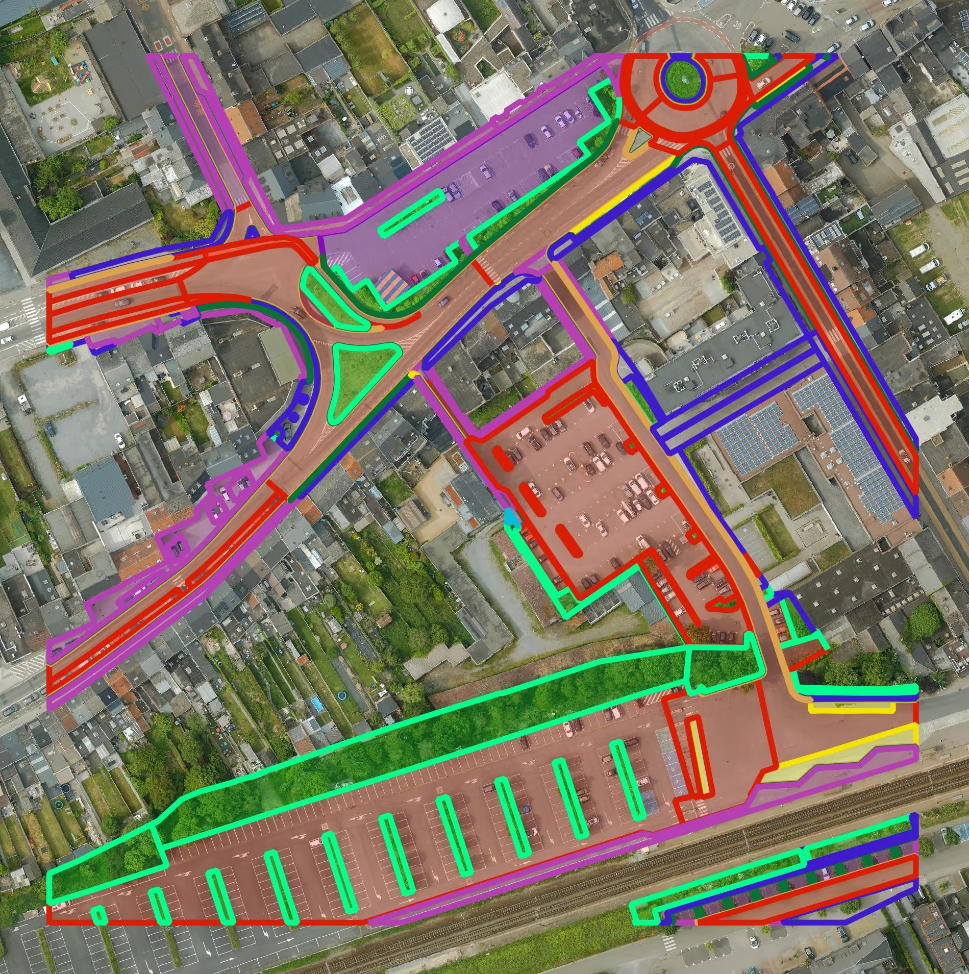
Get a detailed map layer of the public space with classification by object and material. Ideal for anyone working with geospatial data who needs more detail than existing reference data provides.
read more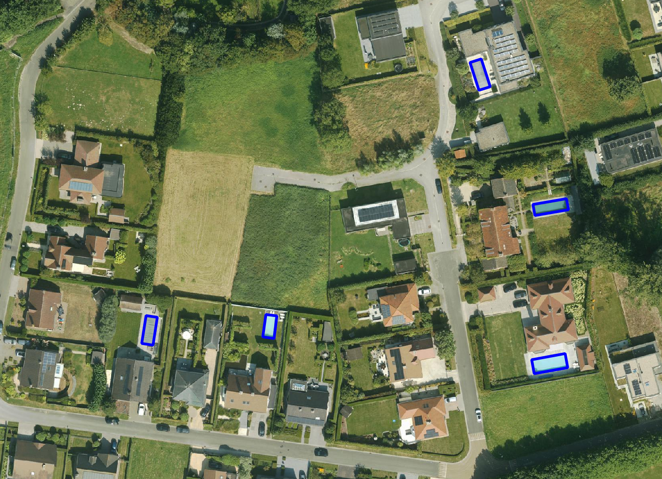
Get a detailed map layer of swimming pools at parcel or object level, including surface area calculations. Ideal for anyone using geospatial data for policy analysis, permits or trend research.
read more
Get a complete inventory of all road markings within your project area, classified into objects, lines and surfaces and linked to the correct underlying surface. This gives you objective data to support maintenance planning, reporting and policy decisions around mobility and asset management.
read more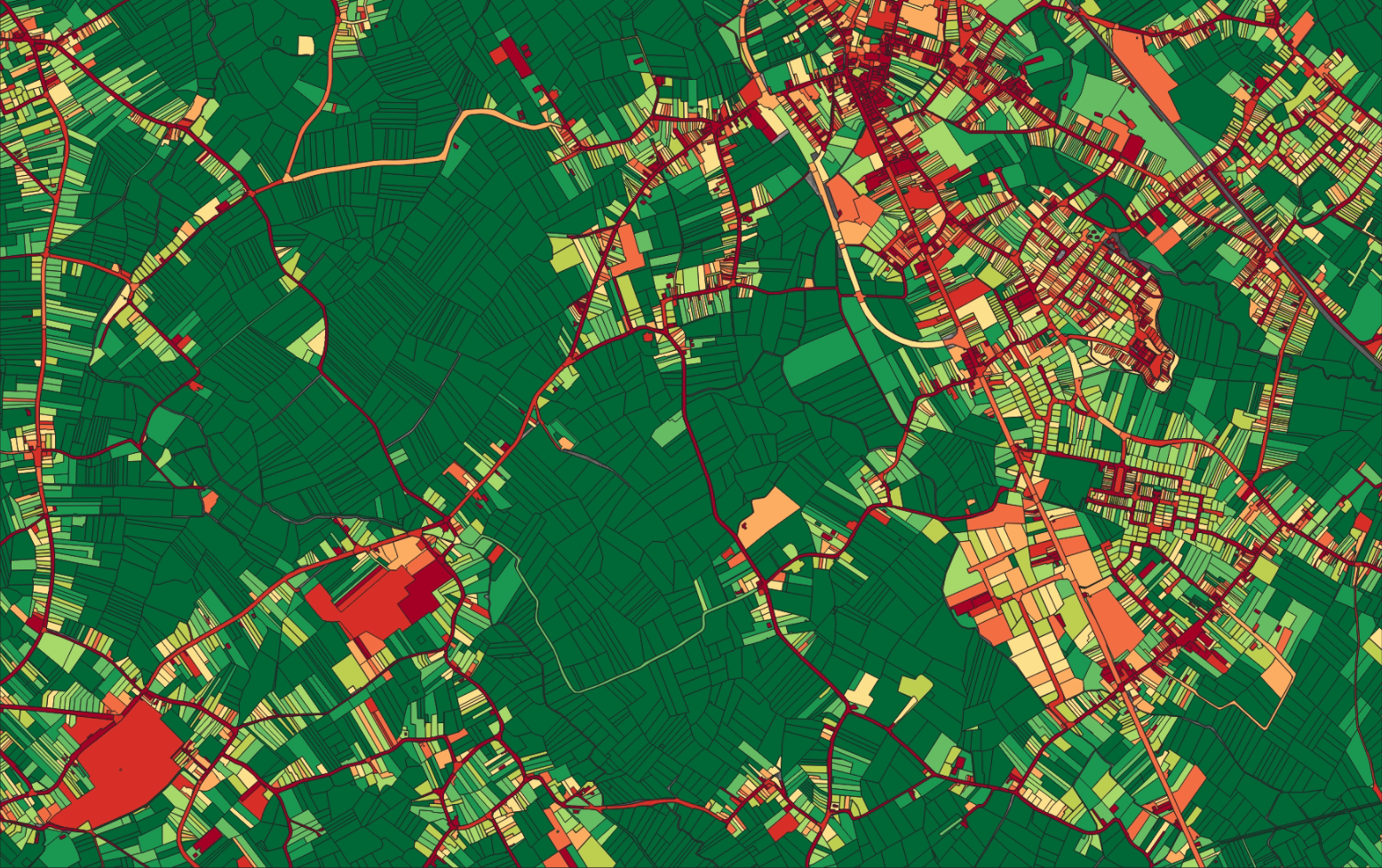
Our paved/unpaved surface maps provide a complete and objective overview of where the ground is paved or unpaved, in both private and public space.
read moreEvery possible element of a cemetery is mapped. The result is a clear and organised plan that supports efficient and transparent cemetery management.
read more
Do you need a specific inventory that is not yet in our offering? We develop custom inventories tailored to your project. Thanks to our experience with aerial imagery and Deep Learning, we can detect and map almost any object type. Get in touch to discuss the possibilities.
Get in touchBy 2040, Flanders must be asbestos-safe. Our aerial imagery and Deep Learning flag which roofs are suspected per address, so we can work together efficiently towards a healthier and safer living environment.
read moreGet a complete overview of trees in your area, including individual characteristics such as crown area and height, and use the data to apply the European 3-30-300 rule for optimal urban greening. Ideal for municipalities, planners and green space managers who need accurate, scalable and policy-relevant geospatial data.
read moreGet a detailed map layer of solar panels at building or cluster level, including surface area calculations per cluster. Ideal for anyone working with geospatial data who wants insight into energy potential and roof utilisation.
read more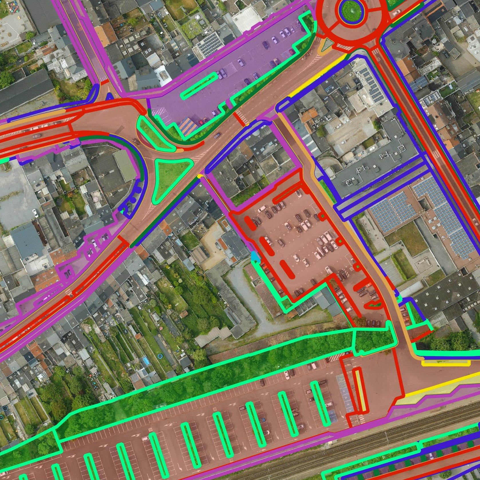
Get a detailed map layer of the public space with classification by object and material. Ideal for anyone working with geospatial data who needs more detail than existing reference data provides.
read moreGet a detailed map layer of swimming pools at parcel or object level, including surface area calculations. Ideal for anyone using geospatial data for policy analysis, permits or trend research.
read moreGet a complete inventory of all road markings within your project area, classified into objects, lines and surfaces and linked to the correct underlying surface. This gives you objective data to support maintenance planning, reporting and policy decisions around mobility and asset management.
read moreOur pavement surface maps provide a complete and objective overview of where the ground is paved or unpaved, in both private and public space.
read moreEvery possible element of a cemetery is mapped. The result is a clear and organised plan that supports efficient and transparent cemetery management.
read moreDo you need a specific inventory that is not yet in our offering? We develop custom inventories tailored to your project. Thanks to our experience with aerial imagery and Deep Learning, we can detect and map almost any object type. Get in touch to discuss the possibilities.
Get in touch
Analyse sites, inspect buildings and manage public space easily online. No GIS knowledge is needed. Use the most current and detailed geospatial data available.

View networks and infrastructure clearly. Plan maintenance and inspections. Integrate your own GIS and WMS/WFS data for a complete picture.

Inspect parcels and buildings. Measure surface areas and distances. Combine your own project data for smart construction planning accessible to all stakeholders.
Analyse sites, inspect buildings and manage public space easily online. No GIS knowledge is needed. Use the most current and detailed geospatial data available.
View networks and infrastructure clearly. Plan maintenance and inspections. Integrate your own GIS and WMS/WFS data for a complete picture.
Inspect parcels and buildings. Measure surface areas and distances. Combine your own project data for smart construction planning accessible to all stakeholders.

